

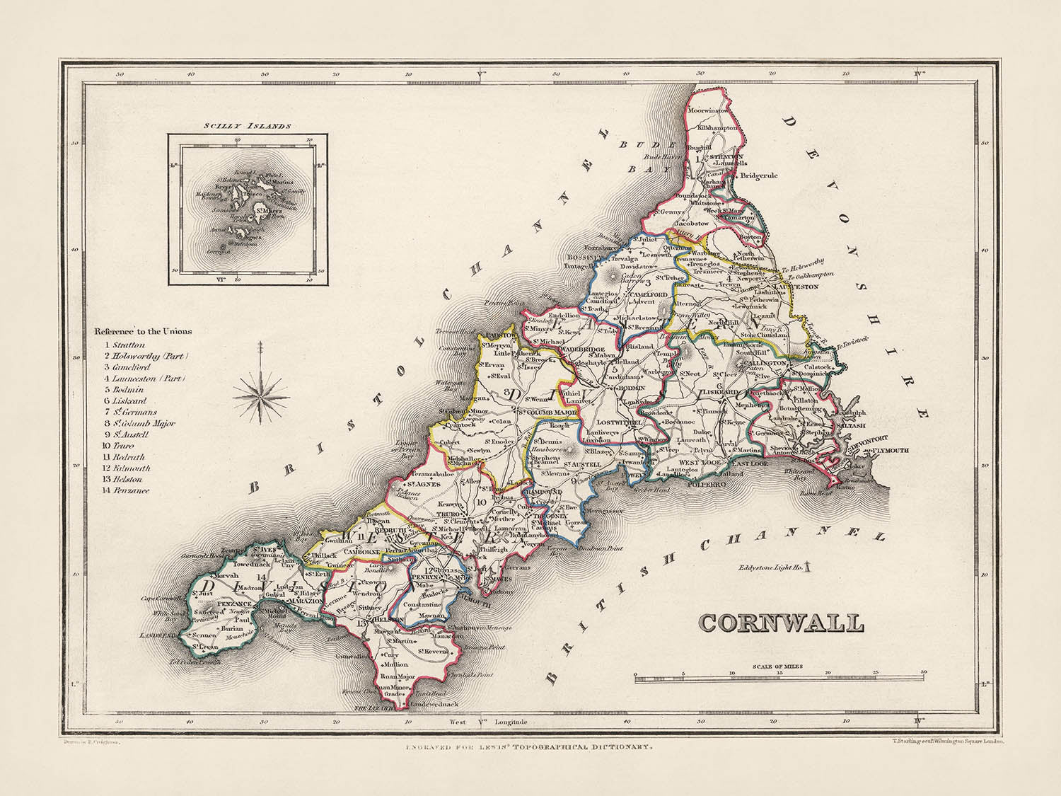


Rare Old Map of Cornwall by Samuel Lewis, 1844: St Austell, Truro, Falmouth, Penzance, and Newquay
The Collector’s Offer
Choose two eligible works and receive 20% off both. Choose three and the lowest-priced one is complimentary, a maximum saving of 33%.
Mix and match eligible standard maps and fine-art prints. No code is required; the offer is applied automatically at checkout.
Standard made-to-order configurations are included. Bespoke sizes, personalised designs and commissioned work are excluded.
Need delivery to different addresses? Contact us before ordering.The Collector’s Offer
Choose two eligible works and receive 20% off both. Choose three and the lowest-priced one is complimentary, a maximum saving of 33%.
Mix and match eligible standard maps and fine-art prints. No code is required; the offer is applied automatically at checkout.
Standard made-to-order configurations are included. Bespoke sizes, personalised designs and commissioned work are excluded.
Need delivery to different addresses? Contact us before ordering. Restored in London • Made in the EU

Restored from the original 1844 map and printed to museum-grade archival standards. Read the story behind this map
Choose your size
Choose your finish


(More info)
Gift message & custom finish

If you want to add a gift message, or a finish (jigsaw, aluminium board, etc.) that is not available here, please request it in the "order note" when you check out.
Every order is custom made, so if you need the size adjusted slightly, or printed on an unusual material, just let us know. We've done thousands of custom orders over the years, so there's (almost) nothing we can't manage.
You can also contact us before you order, if you prefer!

- Made locally for fast, safe delivery
- No import duty or hidden fees
- Need advice? Call us or message on WhatsApp
Own a piece of history
8,000+ five-star reviews


Immerse yourself in a riveting journey through time with this pristine 1844 map of Cornwall County by Samuel Lewis. This captivating artifact...
Continue readingImmerse yourself in a riveting journey through time with this pristine 1844 map of Cornwall County by Samuel Lewis. This captivating artifact not only offers an engaging insight into Cornwall as it was in the mid-19th century but also serves as a bridge to its vibrant past. It stands as a testament to the roots of Cornwall's modern landscape, including towns that you may not find under the same names today.
Here's a thrilling opportunity to explore this piece of history where you might discover early iterations of modern towns, or in some exciting instances, settlements that may not appear at all on contemporary maps. This map also features an inset map of the Scilly Isles, adding another layer of intrigue to this already fascinating piece.
Settlements within the historical boundaries of Cornwall
- St Austell: Founded in the 12th century. Notable for its china clay industry.
- Truro: Established as a town in the 12th century. Known for Truro Cathedral and as Cornwall's administrative center.
- Falmouth: Chartered in 1661. Famous for its deep natural harbor.
- Penzance: Received market rights in 1332. Gateway to the Isles of Scilly.
- Newquay: Known as a fishing village in the 15th century. Famous as a surfing destination.
- Camborne: Mentioned in the Domesday Book, 1086. Historic mining town.
- Redruth: Known to exist since the 12th century. Another center of the Cornish mining industry.
- Saltash: Referred to as a market town in the 12th century. Known for the Royal Albert Bridge.
- Bodmin: Recorded in the Domesday Book, 1086. Home to Bodmin Jail and Bodmin Moor.
- St Ives: Mentioned in records from the 5th century. Notable as an artists' haven.
- Liskeard: Mentioned in the Domesday Book, 1086. Gateway to Bodmin Moor.
- Launceston: Recorded in the Domesday Book, 1086. Historic capital of Cornwall.
- Helston: Known as a town since at least 1086. Famous for the Furry Dance.
- Porthleven: Established as a harbor in the early 19th century. Known for its iconic clock tower.
- Torpoint: Known from the 18th century. Famous for its ferry service to Plymouth.
- Hayle: Known as a settlement from the early 18th century. Notable for its industrial heritage.
- Wadebridge: Known as a town since the 15th century. Renowned for the Royal Cornwall Show.
- St Just: Recorded in the 15th century. Famous for its mining history.
- Padstow: Known as a port since the 10th century. Renowned for its food festival.
- Bude: Known as a harbor town since the 16th century. Notable for its beaches.
- Callington: Mentioned in the 7th century. Famous for its mural trail.
- Lostwithiel: Known from the 12th century. Once the capital of Cornwall.
- St Mawes: Known since the 16th century. Famous for St Mawes Castle.
- Looe: Known since the 13th century. Notable as a fishing town.
- Fowey: Known since the 14th century. Famous for its literary festival.
- St Agnes: Known since the 15th century. Rich mining heritage.
- St Columb Major: Recorded in the 9th century. Known for its historic Hurling the Silver Ball.
- Perranporth: Known since the 19th century. Renowned for its wide sandy beach.
- Tintagel: Mentioned in the 12th century. Associated with the legends of King Arthur.
- Port Isaac: Known since the 14th century. Known for the TV series 'Doc Martin'.
Notable natural attractions in Cornwall
Land's End, the most westerly point of mainland England, the Eden Project, an ecosystem complex and tourist attraction, and Bodmin Moor, a designated Area of Outstanding Natural Beauty.
Historical events in Cornwall (1800-1850)
During the period 1800-1850, Cornwall was buzzing with activity, especially due to the mining boom. The area became globally recognized for its production of tin and copper. The Royal Geological Society of Cornwall was established in 1814, further emphasizing the significance of mining and geological studies in this region. The founding of the Cornwall Railway in 1846 was another significant event, marking a new era of transportation in the county.
Please double check the images to make sure that a specific town or place is shown on this map. You can also get in touch and ask us to check the map for you.
This map looks great at all sizes: 8x10in (20.5x25.5cm), 12x16in (30.5x41cm), 18x24in (45.5x61cm), 16x20in (40.5x51cm), 24x36in (61x91.5cm), 30x40in (76x101.5cm) and 37x50in (94x127cm), but it looks even better when printed large.
I can create beautiful, large prints of this map up to 50in (127cm). Please get in touch if you're looking for larger, customised or different framing options.
The model in the listing images is holding the 18x24in (45.5x61cm) version of this map.
The fifth listing image shows an example of my map personalisation service.
If you’re looking for something slightly different, check out my main collection of UK and Ireland maps.
Please contact me to check if a certain location, landmark or feature is shown on this map.
This would make a wonderful birthday, Christmas, Father's Day, work leaving, anniversary or housewarming gift for someone from the areas covered by this map.
This map is available as a giclée print on acid free archival matte paper, or you can buy it framed. The frame is a nice, simple black frame that suits most aesthetics. Please get in touch if you'd like a different frame colour or material. My frames are glazed with super-clear museum-grade acrylic (perspex/acrylite), which is significantly less reflective than glass, safer, and will always arrive in perfect condition.
This map is also available as a float framed canvas, sometimes known as a shadow gap framed canvas or canvas floater. The map is printed on artist's cotton canvas and then stretched over a handmade box frame. We then "float" the canvas inside a wooden frame, which is available in a range of colours (black, dark brown, oak, antique gold and white). This is a wonderful way to present a map without glazing in front. See some examples of float framed canvas maps and explore the differences between my different finishes.
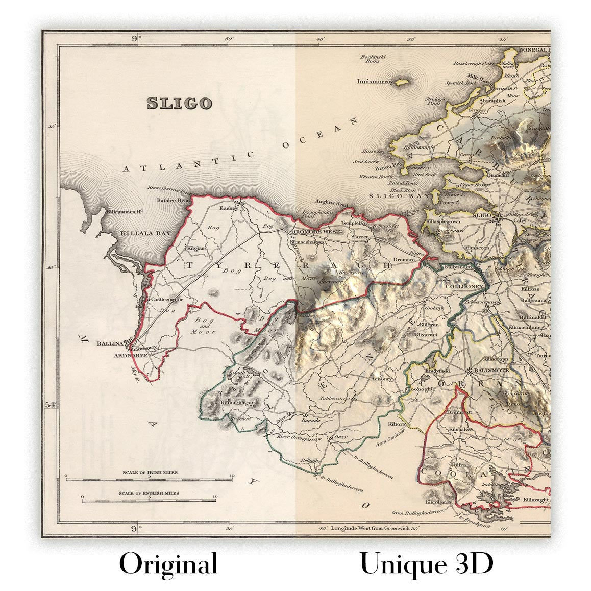
For something truly unique, this map is also available in "Unique 3D", our trademarked process that dramatically transforms the map so that it has a wonderful sense of depth. We combine the original map with detailed topography and elevation data, so that mountains and the terrain really "pop". For more info and examples of 3D maps, check my Unique 3D page.
Immerse yourself in a riveting journey through time with this pristine 1844 map of Cornwall County by Samuel Lewis. This captivating artifact not only offers an engaging insight into Cornwall as it was in the mid-19th century but also serves as a bridge to its vibrant past. It stands as a testament to the roots of Cornwall's modern landscape, including towns that you may not find under the same names today.
Here's a thrilling opportunity to explore this piece of history where you might discover early iterations of modern towns, or in some exciting instances, settlements that may not appear at all on contemporary maps. This map also features an inset map of the Scilly Isles, adding another layer of intrigue to this already fascinating piece.
Settlements within the historical boundaries of Cornwall
- St Austell: Founded in the 12th century. Notable for its china clay industry.
- Truro: Established as a town in the 12th century. Known for Truro Cathedral and as Cornwall's administrative center.
- Falmouth: Chartered in 1661. Famous for its deep natural harbor.
- Penzance: Received market rights in 1332. Gateway to the Isles of Scilly.
- Newquay: Known as a fishing village in the 15th century. Famous as a surfing destination.
- Camborne: Mentioned in the Domesday Book, 1086. Historic mining town.
- Redruth: Known to exist since the 12th century. Another center of the Cornish mining industry.
- Saltash: Referred to as a market town in the 12th century. Known for the Royal Albert Bridge.
- Bodmin: Recorded in the Domesday Book, 1086. Home to Bodmin Jail and Bodmin Moor.
- St Ives: Mentioned in records from the 5th century. Notable as an artists' haven.
- Liskeard: Mentioned in the Domesday Book, 1086. Gateway to Bodmin Moor.
- Launceston: Recorded in the Domesday Book, 1086. Historic capital of Cornwall.
- Helston: Known as a town since at least 1086. Famous for the Furry Dance.
- Porthleven: Established as a harbor in the early 19th century. Known for its iconic clock tower.
- Torpoint: Known from the 18th century. Famous for its ferry service to Plymouth.
- Hayle: Known as a settlement from the early 18th century. Notable for its industrial heritage.
- Wadebridge: Known as a town since the 15th century. Renowned for the Royal Cornwall Show.
- St Just: Recorded in the 15th century. Famous for its mining history.
- Padstow: Known as a port since the 10th century. Renowned for its food festival.
- Bude: Known as a harbor town since the 16th century. Notable for its beaches.
- Callington: Mentioned in the 7th century. Famous for its mural trail.
- Lostwithiel: Known from the 12th century. Once the capital of Cornwall.
- St Mawes: Known since the 16th century. Famous for St Mawes Castle.
- Looe: Known since the 13th century. Notable as a fishing town.
- Fowey: Known since the 14th century. Famous for its literary festival.
- St Agnes: Known since the 15th century. Rich mining heritage.
- St Columb Major: Recorded in the 9th century. Known for its historic Hurling the Silver Ball.
- Perranporth: Known since the 19th century. Renowned for its wide sandy beach.
- Tintagel: Mentioned in the 12th century. Associated with the legends of King Arthur.
- Port Isaac: Known since the 14th century. Known for the TV series 'Doc Martin'.
Notable natural attractions in Cornwall
Land's End, the most westerly point of mainland England, the Eden Project, an ecosystem complex and tourist attraction, and Bodmin Moor, a designated Area of Outstanding Natural Beauty.
Historical events in Cornwall (1800-1850)
During the period 1800-1850, Cornwall was buzzing with activity, especially due to the mining boom. The area became globally recognized for its production of tin and copper. The Royal Geological Society of Cornwall was established in 1814, further emphasizing the significance of mining and geological studies in this region. The founding of the Cornwall Railway in 1846 was another significant event, marking a new era of transportation in the county.
Please double check the images to make sure that a specific town or place is shown on this map. You can also get in touch and ask us to check the map for you.
This map looks great at all sizes: 8x10in (20.5x25.5cm), 12x16in (30.5x41cm), 18x24in (45.5x61cm), 16x20in (40.5x51cm), 24x36in (61x91.5cm), 30x40in (76x101.5cm) and 37x50in (94x127cm), but it looks even better when printed large.
I can create beautiful, large prints of this map up to 50in (127cm). Please get in touch if you're looking for larger, customised or different framing options.
The model in the listing images is holding the 18x24in (45.5x61cm) version of this map.
The fifth listing image shows an example of my map personalisation service.
If you’re looking for something slightly different, check out my main collection of UK and Ireland maps.
Please contact me to check if a certain location, landmark or feature is shown on this map.
This would make a wonderful birthday, Christmas, Father's Day, work leaving, anniversary or housewarming gift for someone from the areas covered by this map.
This map is available as a giclée print on acid free archival matte paper, or you can buy it framed. The frame is a nice, simple black frame that suits most aesthetics. Please get in touch if you'd like a different frame colour or material. My frames are glazed with super-clear museum-grade acrylic (perspex/acrylite), which is significantly less reflective than glass, safer, and will always arrive in perfect condition.
This map is also available as a float framed canvas, sometimes known as a shadow gap framed canvas or canvas floater. The map is printed on artist's cotton canvas and then stretched over a handmade box frame. We then "float" the canvas inside a wooden frame, which is available in a range of colours (black, dark brown, oak, antique gold and white). This is a wonderful way to present a map without glazing in front. See some examples of float framed canvas maps and explore the differences between my different finishes.
For something truly unique, this map is also available in "Unique 3D", our trademarked process that dramatically transforms the map so that it has a wonderful sense of depth. We combine the original map with detailed topography and elevation data, so that mountains and the terrain really "pop". For more info and examples of 3D maps, check my Unique 3D page.
Many of our maps and art prints are chosen as thoughtful gifts for homes, offices, studies and meaningful places.
Choose a framed option for the easiest ready-to-hang gift, or choose an unframed print if the recipient may prefer to select their own frame.
We make orders locally in 23 countries around the world, so gifts can often be produced close to the recipient. This helps them arrive faster, travel more safely, and avoid customs or import duty surprises.
- We can deliver directly to the recipient
- Framed pieces arrive ready to hang
- Unframed prints are carefully packed in a strong protective tube
- Almost every order is made locally, for faster, safer gifting
- 90-day returns give the recipient time to decide
If you are not sure what to choose, please contact us. We can help you pick the right map, size, finish or delivery option.
Most orders are made locally and delivered in around 2–3 working days, depending on the product, size and destination.
We print and frame maps and artwork in 23 countries around the world, so your order is usually made close to you or your recipient. That means faster delivery, less time in transit, and no customs or import duty surprises.
Personalised and customised pieces usually take an extra 1–2 working days, because we prepare your design and send it to you for approval before printing.
Very large framed orders can take a little longer, as they need extra care in production and delivery.
Every order is carefully packaged: unframed prints are sent in a strong protective tube, while framed pieces are securely packed with protective materials around the frame.
If you need your order by a particular date, please contact us before ordering. We’ll check the best production route and delivery option for your location.
Express delivery is available at checkout for most countries. Next-day delivery is available in the UK, US, Singapore and the UAE.
Your order is covered by our 90-day returns policy and 10-year guarantee.
Our standard frame is a gallery-style black ash hardwood frame, with a simple, modern look. It is approximately 20mm (0.8in) wide. You can also view some lovely customer photos of framed maps and art.
We use super-clear acrylic glazing, also known as Perspex or Acrylite, instead of traditional glass. It is lighter, safer, and has lower reflectivity, giving the artwork a clearer, cleaner appearance.
Six standard frame colours are available at no extra cost: black, dark brown, dark grey, oak, white, and antique gold. Custom framing and mounting/matting is also available for customers looking for something more specific.
Most maps, art prints, and illustrations are also available as a framed canvas. We use matte cotton canvas, stretch it over a sustainably sourced wooden box frame, and then float the piece within a wooden outer frame. The finished result is beautifully presented, with no glazing between you and the artwork.
All frames are supplied ready to hang, with either string or brackets fitted to the back. Very large frames will include heavy-duty hanging plates and/or a mounting baton. If you have any questions, please get in touch.
We can also supply old maps and artwork on canvas, foam board, cotton rag, and other materials.
If you would prefer to frame your map or artwork yourself, please read our size guide before ordering.
Every Unique Maps piece begins with an authentic cartographic source or an original design from our London studio.
For our historic maps, we source rare originals from libraries, archives, auction houses and private collections around the world. We carefully restore each map for print—repairing age-related damage, balancing colour and improving clarity while preserving its original detail, texture and character.
Once restored, the map is prepared for your chosen size and finish. Your piece is then printed and, where selected, framed close to its delivery destination.
Our map prints use acid-free 200gsm archival matte paper and fade-resistant pigment inks, creating a rich, non-glossy finish designed to last. Framed maps use crystal-clear optical acrylic and arrive ready to hang.
Canvas, cotton-rag and other specialist presentations are also available. Learn more about our materials and finishes.
Personalising your map
You can add a short title or dedication, mark one meaningful place, or request one considered visual detail. For personalised designs, we send a proof before printing and you can request changes before approval.
For more complex bespoke commissions, contact our design team.
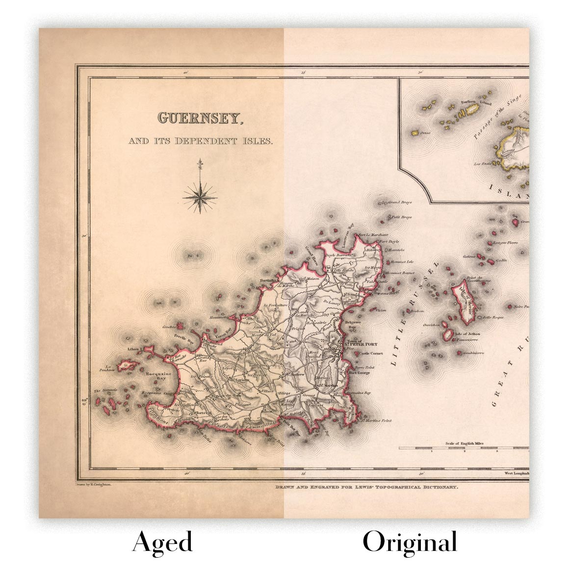
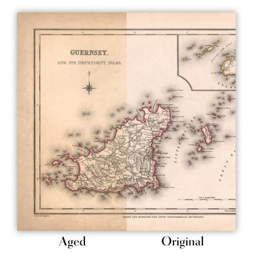
Original or Aged
Choose Original for true-to-source colour, or Aged for a warmer, richer antique character created with our specialist ageing process. See examples of our Aged maps.
If you are not happy with your order for any reason, contact me and I'll get it fixed ASAP, free of charge. Please see my returns and refund policy for more information.
I am very confident you will like your restored map or art print. I have been doing this since 1984. I'm a 5-star Etsy seller. I have sold tens of thousands of maps and art prints and have over 5,000 real 5-star reviews. My work has been featured in interior design magazines, on the BBC, and on the walls of dozens of 5-star hotels.
I use a unique process to restore maps and artwork that is massively time consuming and labour intensive. Hunting down the original maps and illustrations can take months. I use state of the art and eye-wateringly expensive technology to scan and restore them. As a result, I guarantee my maps and art prints are a cut above the rest. I stand by my products and will always make sure you're 100% happy with what you receive.
Almost all of my maps and art prints look amazing at large sizes (200cm, 6.5ft+) and I can frame and deliver them to you as well, via special oversized courier. Contact me to discuss your specific needs.
Or try searching for something!


