









Old Chart of the World's Tallest Waterfalls by Smith, 1836: Handcoloured, Niagara, Gavarnie Falls, Staubbach
Authentic artwork
The artwork we print is faithfully restored from the original source - usually a museum, auction house or private collection.
We never replace, redraw or invent the artist’s work using generative AI.
Restored in our workshop from the original 1836 artwork and printed to museum-grade archival standards. Full description
The Collector’s Offer
Choose two eligible works and receive 25% off both. You can mix and match both maps and art.
No code is required. The offer is applied automatically.
Full terms and conditions
The Collector’s Offer applies to eligible works in standard made-to-order configurations. Bespoke sizes, personalised designs and commissioned work are excluded. Products with “personalised” or “custom” in their name are generally excluded.
The offer is administered as two separate automatic discounts: one for smaller formats and one for larger formats. To qualify, you must purchase two eligible works within the same format group. Maps and art prints may be mixed and matched within each group.
For example, two eligible A4 or 8 × 10 in prints qualify for 25% off both. One smaller-format print and one larger-format work do not qualify together, as items from different format groups cannot be combined to meet the two-item requirement.
No discount code is required. Any qualifying discount is applied automatically in your basket and at checkout.
The Collector’s Offer
Choose two eligible works and receive 25% off both. You can mix and match both maps and art.
No code is required. The offer is applied automatically.
Full terms and conditions
The Collector’s Offer applies to eligible works in standard made-to-order configurations. Bespoke sizes, personalised designs and commissioned work are excluded. Products with “personalised” or “custom” in their name are generally excluded.
The offer is administered as two separate automatic discounts: one for smaller formats and one for larger formats. To qualify, you must purchase two eligible works within the same format group. Maps and art prints may be mixed and matched within each group.
For example, two eligible A4 or 8 × 10 in prints qualify for 25% off both. One smaller-format print and one larger-format work do not qualify together, as items from different format groups cannot be combined to meet the two-item requirement.
No discount code is required. Any qualifying discount is applied automatically in your basket and at checkout.
 Restored in London • Printed and framed in the EU

Authentic artwork
The artwork we print is faithfully restored from the original source - usually a museum, auction house or private collection.
We never replace, redraw or invent the artist’s work using generative AI.
Restored from the original 1836 artwork and printed to museum-grade archival standards. Full description
Choose your size
Choose your finish


(More info)
Gift message & custom finish

If you want to add a gift message, or a finish (jigsaw, aluminium board, etc.) that is not available here, please request it in the "order note" when you check out.
Every order is custom made, so if you need the size adjusted slightly, or printed on an unusual material, just let us know. We've done thousands of custom orders over the years, so there's (almost) nothing we can't manage.
You can also contact us before you order, if you prefer!
- Made in the EU for fast, safe delivery
- Arrives perfect - or we replace it
-
Christmas delivery & gifting Christmas delivery & gifting
Beat the Christmas rush—order early.
Delivery options
Enjoy free standard delivery to anywhere in the world. Free delivery usually arrives in 3 business days. Express or and next-day options are available at the checkout.
Personalised pieces need time for design and proof approval before printing. More delivery info.
Send it straight to them
Simply enter the recipient’s delivery address at checkout. Add a gift message in the order notes and we’ll print it on a branded card. We don’t include prices in the parcel.
Time to choose with confidence
Standard orders can be returned or exchanged within 90 days of delivery. Personalised and custom-made pieces are generally excluded from change-of-mind returns. See our returns policy.
Arrives perfect—or we replace it
If your order arrives damaged, send us a few photos and we’ll arrange a replacement free of charge.
Have a question about your gift? Contact the workshop.
- Need help ordering?
Chosen by collectors, designers and gift buyers
8,000+ five-star reviews


Step into the captivating world of 19th-century cartography with "A Comparative Picture of the Principal Waterfalls in the World," an exquisite creation...
Continue readingStep into the captivating world of 19th-century cartography with "A Comparative Picture of the Principal Waterfalls in the World," an exquisite creation by C Smith & Son from 1836. This thematic map, one of the earliest known comparative views of the world's waterfalls in color, offers a unique visual representation of some of the most magnificent natural wonders across the globe. The map's primary focus is on the heights and geographic distribution of these waterfalls, arranged strategically for easy comparison. From the towering "Cataract of Gavarny" in the Pyrenees to the "Last cataract of the Nile," this map provides a fascinating insight into the grandeur of these natural features.
The infographic style of this map is both informative and visually stunning, with each waterfall meticulously illustrated and labeled with its respective height. This artistic approach not only enhances the map's aesthetic appeal but also serves as an educational tool, allowing viewers to appreciate the relative scale of these waterfalls. The inclusion of detailed notes and remarks adds further context, offering additional information about each waterfall's unique characteristics and significance.
C Smith & Son, renowned for their detailed and artistic maps, have masterfully combined art and science in this creation. Their expertise in cartography is evident in the precision and clarity of the illustrations, making this map a valuable piece for both collectors and enthusiasts of natural history. The map's design reflects the 19th-century fascination with exploration and the natural world, capturing the imagination of viewers with its vivid depiction of these awe-inspiring waterfalls.
The map's geographic scope is impressive, covering waterfalls from Europe, Africa, and the Americas. Notable locations include the majestic falls of the Missouri and Niagara in the United States, the picturesque Staubbach in Switzerland, and the powerful Tequendama in Colombia. Each waterfall is depicted in a way that highlights its unique beauty and grandeur, offering a global perspective on these natural wonders.
This map is not just a visual delight but also a historical artifact that provides insight into the scientific and artistic endeavors of the 19th century. It serves as a testament to the era's dedication to understanding and documenting the natural world. Whether you are a collector, a history enthusiast, or simply someone who appreciates the beauty of nature, "A Comparative Picture of the Principal Waterfalls in the World" is a remarkable piece that will add depth and elegance to any collection.
Places on this map
- Cataract of Gavarny (Pyrenees)
- Staubbach (Switzerland)
- Dunder Foss (Norway)
- Fall of Trolhätten (Sweden)
- Fall of the Tequendama (Colombia)
- Falls of the Missouri (USA)
- Fall of the River Montmorenci (Canada)
- Falls of the Rhine (Switzerland)
- Pisse Vache (Switzerland)
- Fall of the Clyde (Scotland)
- Waleh (Africa)
- Fall of the River Arve (France)
- Fall of the River Velino (Italy)
- Fall of the River Sigu (Africa)
- Fall of the River Foyers (Scotland)
- Fall of the River Garry (Scotland)
- Fall of the River Niagara (USA/Canada)
- Fall of the River Genesee (USA)
- Fall of the River Trenton (USA)
- Fall of the River Passaic (USA)
- Fall of the River Schuylkill (USA)
- Fall of the River Cohoes (USA)
- Fall of the River Mohawk (USA)
- Fall of the River Hudson (USA)
- Last cataract of the Nile (Egypt)
Notable Features & Landmarks
- Heights of various waterfalls around the world.
- Geographic locations of these waterfalls.
- Detailed notes and remarks providing additional information about each waterfall.
- Artistic depiction enhancing visual appeal and educational value.
- Highlights the diversity and grandeur of natural landscapes.
- Reflects 19th-century interest in natural wonders and geographic exploration.
- Provides a visual tool for understanding the relative scale of waterfalls.
Historical and design context
- Name of the map: A Comparative Picture of the Principal Waterfalls in the World
- Probably one of the earliest comparative views of the world's waterfalls in color.
- Waterfalls are strategically arranged for comparison from Europe and Africa to the Americas.
- The highest waterfall shown is the "Cataract of Gavarny (Pyrenees)".
- The lowest waterfall shown is the "Last cataract of the Nile".
- Includes remarks and notes for additional context.
- Date of creation: 1836
- Mapmaker/Publisher: C Smith & Son
- C Smith & Son were known for creating detailed and artistic maps and prints during the 19th century.
- Infographic thematic map with artistic illustrations.
- Colorful depiction for visual comparison.
- Detailed labeling of each waterfall with height measurements.
- Reflects 19th-century fascination with exploration and the natural world.
Please double check the images to make sure that a specific town or place is shown on this map. You can also get in touch and ask us to check the map for you.
This map looks great at every size, but I always recommend going for a larger size if you have space. That way you can easily make out all of the details.
This map looks amazing at sizes all the way up to 70in (180cm). If you are looking for a larger map, please get in touch.
Please note: the labels on this map are hard to read if you order a map that is 16in (40cm) or smaller. The map is still very attractive, but if you would like to read the map easily, please buy a larger size.
The model in the listing images is holding the 18x24in (45x60cm) version of this map.
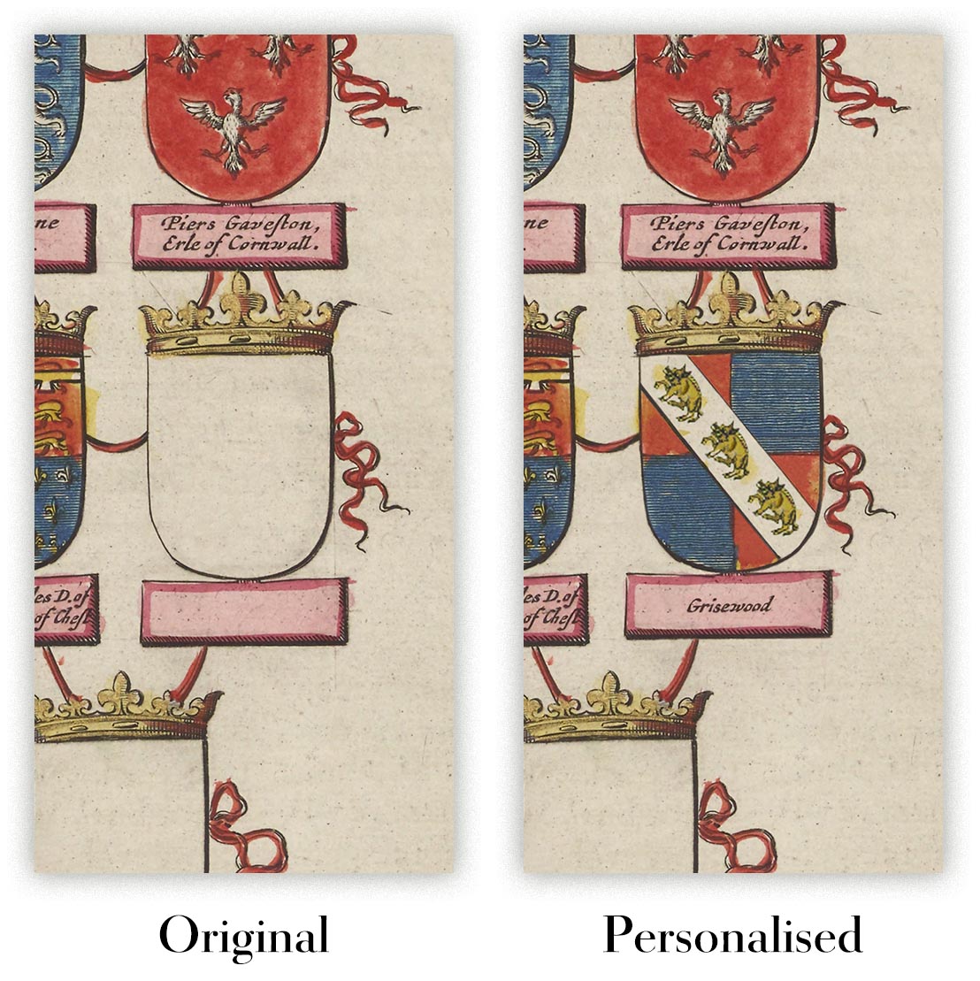
The fifth listing image shows an example of my map personalisation service.
If you’re looking for something slightly different, check out my collection of the best old maps to see if something else catches your eye.
Please contact me to check if a certain location, landmark or feature is shown on this map.
This would make a wonderful birthday, Christmas, Father's Day, work leaving, anniversary or housewarming gift for someone from the areas covered by this map.
This map is available as a giclée print on acid free archival matte paper, or you can buy it framed. The frame is a nice, simple black frame that suits most aesthetics. Please get in touch if you'd like a different frame colour or material. My frames are glazed with super-clear museum-grade acrylic (perspex/acrylite), which is significantly less reflective than glass, safer, and will always arrive in perfect condition.
This artwork is also available as a float framed canvas, sometimes known as a shadow gap framed canvas or canvas floater. The work is printed on artist's cotton canvas and then stretched over a handmade box frame. We then "float" the canvas inside a wooden frame, which is available in a range of colours (black, dark brown, oak, antique gold and white). This is a wonderful way to present an art print without glazing in front. See some examples of float framed canvas art and explore the differences between my different finishes.
Step into the captivating world of 19th-century cartography with "A Comparative Picture of the Principal Waterfalls in the World," an exquisite creation by C Smith & Son from 1836. This thematic map, one of the earliest known comparative views of the world's waterfalls in color, offers a unique visual representation of some of the most magnificent natural wonders across the globe. The map's primary focus is on the heights and geographic distribution of these waterfalls, arranged strategically for easy comparison. From the towering "Cataract of Gavarny" in the Pyrenees to the "Last cataract of the Nile," this map provides a fascinating insight into the grandeur of these natural features.
The infographic style of this map is both informative and visually stunning, with each waterfall meticulously illustrated and labeled with its respective height. This artistic approach not only enhances the map's aesthetic appeal but also serves as an educational tool, allowing viewers to appreciate the relative scale of these waterfalls. The inclusion of detailed notes and remarks adds further context, offering additional information about each waterfall's unique characteristics and significance.
C Smith & Son, renowned for their detailed and artistic maps, have masterfully combined art and science in this creation. Their expertise in cartography is evident in the precision and clarity of the illustrations, making this map a valuable piece for both collectors and enthusiasts of natural history. The map's design reflects the 19th-century fascination with exploration and the natural world, capturing the imagination of viewers with its vivid depiction of these awe-inspiring waterfalls.
The map's geographic scope is impressive, covering waterfalls from Europe, Africa, and the Americas. Notable locations include the majestic falls of the Missouri and Niagara in the United States, the picturesque Staubbach in Switzerland, and the powerful Tequendama in Colombia. Each waterfall is depicted in a way that highlights its unique beauty and grandeur, offering a global perspective on these natural wonders.
This map is not just a visual delight but also a historical artifact that provides insight into the scientific and artistic endeavors of the 19th century. It serves as a testament to the era's dedication to understanding and documenting the natural world. Whether you are a collector, a history enthusiast, or simply someone who appreciates the beauty of nature, "A Comparative Picture of the Principal Waterfalls in the World" is a remarkable piece that will add depth and elegance to any collection.
Places on this map
- Cataract of Gavarny (Pyrenees)
- Staubbach (Switzerland)
- Dunder Foss (Norway)
- Fall of Trolhätten (Sweden)
- Fall of the Tequendama (Colombia)
- Falls of the Missouri (USA)
- Fall of the River Montmorenci (Canada)
- Falls of the Rhine (Switzerland)
- Pisse Vache (Switzerland)
- Fall of the Clyde (Scotland)
- Waleh (Africa)
- Fall of the River Arve (France)
- Fall of the River Velino (Italy)
- Fall of the River Sigu (Africa)
- Fall of the River Foyers (Scotland)
- Fall of the River Garry (Scotland)
- Fall of the River Niagara (USA/Canada)
- Fall of the River Genesee (USA)
- Fall of the River Trenton (USA)
- Fall of the River Passaic (USA)
- Fall of the River Schuylkill (USA)
- Fall of the River Cohoes (USA)
- Fall of the River Mohawk (USA)
- Fall of the River Hudson (USA)
- Last cataract of the Nile (Egypt)
Notable Features & Landmarks
- Heights of various waterfalls around the world.
- Geographic locations of these waterfalls.
- Detailed notes and remarks providing additional information about each waterfall.
- Artistic depiction enhancing visual appeal and educational value.
- Highlights the diversity and grandeur of natural landscapes.
- Reflects 19th-century interest in natural wonders and geographic exploration.
- Provides a visual tool for understanding the relative scale of waterfalls.
Historical and design context
- Name of the map: A Comparative Picture of the Principal Waterfalls in the World
- Probably one of the earliest comparative views of the world's waterfalls in color.
- Waterfalls are strategically arranged for comparison from Europe and Africa to the Americas.
- The highest waterfall shown is the "Cataract of Gavarny (Pyrenees)".
- The lowest waterfall shown is the "Last cataract of the Nile".
- Includes remarks and notes for additional context.
- Date of creation: 1836
- Mapmaker/Publisher: C Smith & Son
- C Smith & Son were known for creating detailed and artistic maps and prints during the 19th century.
- Infographic thematic map with artistic illustrations.
- Colorful depiction for visual comparison.
- Detailed labeling of each waterfall with height measurements.
- Reflects 19th-century fascination with exploration and the natural world.
Please double check the images to make sure that a specific town or place is shown on this map. You can also get in touch and ask us to check the map for you.
This map looks great at every size, but I always recommend going for a larger size if you have space. That way you can easily make out all of the details.
This map looks amazing at sizes all the way up to 70in (180cm). If you are looking for a larger map, please get in touch.
Please note: the labels on this map are hard to read if you order a map that is 16in (40cm) or smaller. The map is still very attractive, but if you would like to read the map easily, please buy a larger size.
The model in the listing images is holding the 18x24in (45x60cm) version of this map.
The fifth listing image shows an example of my map personalisation service.
If you’re looking for something slightly different, check out my collection of the best old maps to see if something else catches your eye.
Please contact me to check if a certain location, landmark or feature is shown on this map.
This would make a wonderful birthday, Christmas, Father's Day, work leaving, anniversary or housewarming gift for someone from the areas covered by this map.
This map is available as a giclée print on acid free archival matte paper, or you can buy it framed. The frame is a nice, simple black frame that suits most aesthetics. Please get in touch if you'd like a different frame colour or material. My frames are glazed with super-clear museum-grade acrylic (perspex/acrylite), which is significantly less reflective than glass, safer, and will always arrive in perfect condition.
This artwork is also available as a float framed canvas, sometimes known as a shadow gap framed canvas or canvas floater. The work is printed on artist's cotton canvas and then stretched over a handmade box frame. We then "float" the canvas inside a wooden frame, which is available in a range of colours (black, dark brown, oak, antique gold and white). This is a wonderful way to present an art print without glazing in front. See some examples of float framed canvas art and explore the differences between my different finishes.
Many of our maps and art prints are chosen as thoughtful gifts for homes, offices, studies and meaningful places.
Choose a framed option for the easiest ready-to-hang gift, or choose an unframed print if the recipient may prefer to select their own frame.
We make orders locally in 24 countries around the world, so gifts can often be produced close to the recipient. This helps them arrive faster, travel more safely, and avoid customs or import duty surprises.
- We can deliver directly to the recipient
- Framed pieces arrive ready to hang
- Unframed prints are carefully packed in a strong protective tube
- Almost every order is made locally, for faster, safer gifting
- 90-day returns give the recipient time to decide
If you are not sure what to choose, please contact us. We can help you pick the right map, size, finish or delivery option.
Most orders are made locally and delivered in around 2–3 working days, depending on the product, size and destination.
We print and frame maps and artwork in 24 countries around the world, so your order is usually made close to you or your recipient. That means faster delivery, less time in transit, and no customs or import duty surprises.
Personalised and customised pieces usually take an extra 1–2 working days, because we prepare your design and send it to you for approval before printing.
Very large framed orders can take a little longer, as they need extra care in production and delivery.
Every order is carefully packaged: unframed prints are sent in a strong protective tube, while framed pieces are securely packed with protective materials around the frame.
If you need your order by a particular date, please contact us before ordering. We’ll check the best production route and delivery option for your location.
Express delivery is available at checkout for most countries. Next-day delivery is available in the UK, US, Singapore and the UAE.
Your order is covered by our 90-day returns policy and 10-year guarantee.
Our standard frame is a gallery-style black ash hardwood frame, with a simple, modern look. It is approximately 20mm (0.8in) wide. You can also view some lovely customer photos of framed maps and art.
We use super-clear acrylic glazing, also known as Perspex or Acrylite, instead of traditional glass. It is lighter, safer, and has lower reflectivity, giving the artwork a clearer, cleaner appearance.
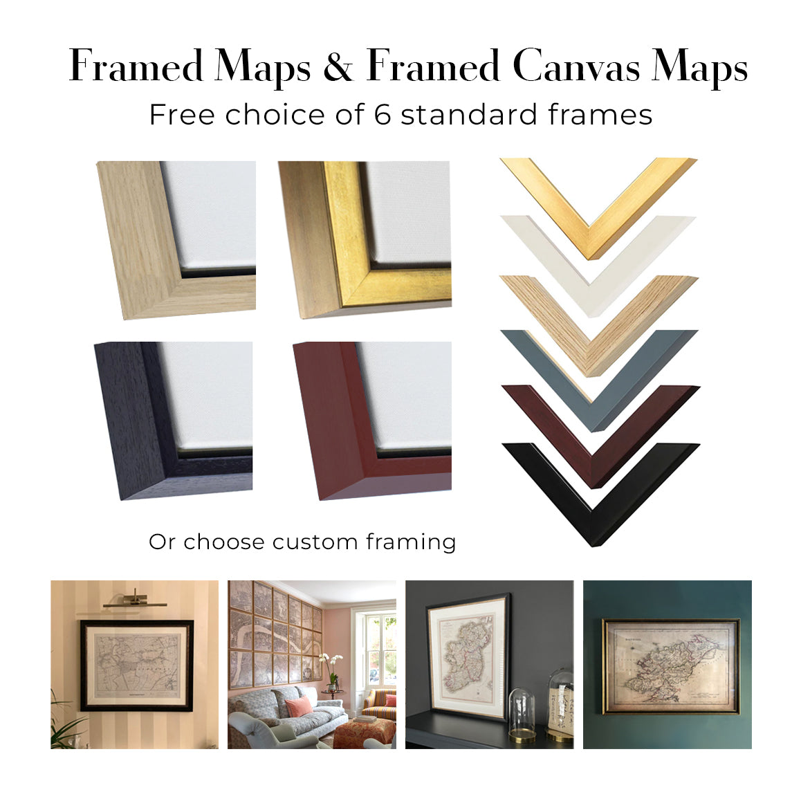
Six standard frame colours are available at no extra cost: black, dark brown, dark grey, oak, white, and antique gold. Custom framing and mounting/matting is also available for customers looking for something more specific.
Most maps, art prints, and illustrations are also available as a framed canvas. We use matte cotton canvas, stretch it over a sustainably sourced wooden box frame, and then float the piece within a wooden outer frame. The finished result is beautifully presented, with no glazing between you and the artwork.
All frames are supplied ready to hang, with either string or brackets fitted to the back. Very large frames will include heavy-duty hanging plates and/or a mounting baton. If you have any questions, please get in touch.
We can also supply old maps and artwork on canvas, foam board, cotton rag, and other materials.
If you would prefer to frame your map or artwork yourself, please read our size guide before ordering.
We work with interior designers, hospitality businesses, property professionals, offices and corporate buyers on individual pieces and larger coordinated projects.
This artwork can be adapted for a particular wall, room or project, and our workshop can help coordinate the dimensions, material and framing before production.
- Exact, oversized and made-to-measure dimensions
- Custom framing, mounting and alternative materials
- Coordinated pieces for several rooms or locations
- Art personalisation, to adjust the colour and style of the piece
- Art and framing guidance from our workshop
- Local production for projects around the world
Every restored art print begins with the original artist’s work—never an AI-generated replacement.
Our London studio works from carefully selected source material from museums, libraries, archives and private collections. We restore age-related damage, faded colour and imperfect reproduction while preserving the artist’s composition, brushwork, line, texture and period character.
We do not use generative AI to redraw, reinterpret or invent the artwork. Digital restoration is used only to recover and reproduce the original work as faithfully as possible.
Once restored, the master artwork is prepared for your chosen size and finish. Your piece is then printed and, where selected, framed close to its delivery destination.
Our giclée art prints use acid-free 200gsm archival matte paper and fade-resistant pigment inks for a rich, museum-quality finish. Framed art prints use crystal-clear optical acrylic and arrive ready to hang.
Framed canvas and specialist cotton-rag editions are also available. Learn more about our materials and finishes.
We’ve been restoring and producing maps and art prints since 1984, and we stand behind every piece.
Every order is covered by our 10-year guarantee and damage-free delivery guarantee. If your piece arrives damaged, we’ll replace or remake it free of charge. If anything else isn’t right, contact our workshop team and we’ll put it right promptly.
See our returns and refund policy for full details.


