


Alte Folklore-Legendenkarte der USA, 1960

-
![]() Handmade locally in the EU
Handmade locally in the EU
-
FREE worldwide delivery in 2-3 days ⓘ
Free delivery in 2-3 days
Your map should be delivered in 2-3 working days with free delivery, worldwide.
We make maps by hand locally in 23 countries, including the EU
![]() . If you're buying a gift for someone in another country, we will make the map locally to them.
. If you're buying a gift for someone in another country, we will make the map locally to them.You will never pay import tax or customs duty.
Express delivery is available at checkout which can reduce the delivery time to 1-2 days.
Please note that personalised maps, and larger framed maps, can take longer to produce and deliver.
If you need your order to arrive by a certain date, contact me and we can discuss your options.
-
90 day money back guarantee
ⓘ
90 Tage für Rückgabe und Rückerstattung
Produkte können innerhalb von 90 Tagen für eine vollständige Rückerstattung oder einen Umtausch gegen ein anderes Produkt zurückgegeben werden.
Für personalisierte oder maßgefertigte Artikel können wir Ihnen möglicherweise Guthaben im Geschäft oder eine nicht ablaufende Geschenkkarte anbieten, da wir personalisierte Bestellungen nicht wiederverkaufen können.
Wenn Sie Fragen haben, nehmen Sie Kontakt auf. Für weitere Informationen siehe unsere vollständige Rückgabe- und Umtauschrichtlinie.

My maps are rare, museum-grade, restored old maps sourced from libraries, auction houses and private collections across the globe.
Framing & free personalisation available
1. Select your size
2. Frame & personalise your map
Make your map unique with framing, hand-drawn customisation, vintage ageing, pop art text, unique 3D styling and moreGeschenkmitteilung & individuelle Ausführung

Wenn Sie eine Geschenkmitteilung oder eine Ausführung (Puzzle, Aluminiumplatte usw.) hinzufügen möchten, die hier nicht verfügbar ist, geben Sie dies bitte in der "Bestellnotiz" beim Checkout an.
Jede Bestellung wird individuell angefertigt. Wenn Sie die Größe leicht anpassen oder auf einem ungewöhnlichen Material drucken lassen möchten, lassen Sie es uns einfach wissen. Wir haben im Laufe der Jahre Tausende von individuellen Bestellungen bearbeitet, daher gibt es (fast) nichts, was wir nicht bewältigen können.
Sie können uns auch kontaktieren, bevor Sie bestellen, wenn Sie möchten!

- Handmade locally. No import duty or tax
- FREE Delivery. Arrives in 2-3 days
- Love it or your money back
- Questions? WhatsApp me any time
Own a piece of history
5,000+ 5 star reviews


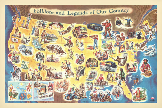
Betreten Sie die lebendige Welt des amerikanischen Mid-Century mit Frank J. Soltesz’s fesselndem Bildband von 1960, "Folklore und Legenden unseres Landes." Diese außergewöhnliche thematische Karte bietet eine verspielte, aber tief informative Reise durch die Vereinigten Staaten, wo jeder Bundesstaat mit Farbe und Charakter erblüht und seine eigene einzigartige Mischung aus Geschichte, Legende und Mythos erzählt. Entworfen mit einem Blick sowohl für Bildung als auch Unterhaltung, zieht Soltesz’s Schöpfung den Betrachter in ein lebhaftes Tableau, in dem Fakten und Folklore miteinander verschmelzen, und macht sie zu einem geschätzten Artefakt für Sammler und Kenner der amerikanischen Kulturgeschichte.
Frank J. Soltesz, bekannt für seine ansprechenden bildlichen Karten, war ein Meister darin, die Fantasie von Jung und Alt einzufangen. Sein Werk steht als Zeugnis für das goldene Zeitalter der Benzinkarten - diese wunderbaren kartografischen Begleiter, die an Tankstellen verteilt wurden, um Neugier und Fernweh bei Reisenden zu wecken. Soltesz’s unverwechselbarer Stil, gekennzeichnet durch reich detaillierte Illustrationen und einen spielerischen, aber informativen Ansatz, sorgt dafür, dass bei jeder Betrachtung neue Geschichten und Charaktere enthüllt werden. Seine Karten sind mehr als Navigationswerkzeuge; sie sind Portale in das kollektive Gedächtnis und die Vorstellungskraft einer Nation.
Die Karte selbst ist ein visuelles Fest, voll mit legendären Figuren wie Paul Bunyan, Pecos Bill, Johnny Appleseed und Davy Crockett, die alle in lebhaften, cartoonhaften Illustrationen dargestellt sind. Wichtige historische Ereignisse, von der Boston Tea Party bis zum Goldrausch, werden neben mythischen Kreaturen wie dem Jackalope und dem Jersey Devil gezeigt, was eine reizvolle Mischung aus Fakten und Fiktion bietet. Natürliche Wunder wie die Niagarafälle, der Grand Canyon und der Mount Rushmore werden mit gleicher Eleganz gefeiert, ihre Größe wird in Soltesz’s lebhaftem Stil verewigt. Jeder Bundesstaat ist sorgfältig umrandet und beschriftet, wodurch die Karte ebenso informativ wie bezaubernd ist.
Über ihre künstlerische Anziehungskraft hinaus bietet die Karte ein reichhaltiges Gewebe der Geographie Amerikas. Der mächtige Mississippi-Fluss schlängelt sich durch das Herzland, die Großen Seen schimmern im Norden, und die Rocky Mountains und Appalachen erheben sich majestätisch über die Landschaft. Der Atlantische und der Pazifische Ozean, der Golf von Mexiko und die Landesgrenzen zu Kanada und Mexiko sind alle elegant umschrieben, was die Folklore in einem greifbaren Sinn von Ort verankert. Diese Aufmerksamkeit für die physische Geographie verstärkt die narrative Kraft der Karte und lädt die Betrachter ein, das Zusammenspiel von Land und Legende zu erkunden.
Städte und Gemeinden sind aufgrund ihrer historischen und kulturellen Bedeutung sorgfältig ausgewählt, wobei New York City, Los Angeles, Chicago und San Francisco neben geschichtsträchtigen Orten wie Boston, New Orleans und Santa Fe stehen. Jede Siedlung ist nicht nur ein Punkt auf der Karte, sondern ein Bezugspunkt für die Geschichten und Traditionen, die die amerikanische Erfahrung prägen. Soltesz’s "Folklore und Legenden unseres Landes" ist mehr als eine Karte - es ist eine Feier der Geschichten, Landschaften und des Geistes, die die Vereinigten Staaten geprägt haben, und macht sie zu einer außergewöhnlichen Ergänzung jeder Sammlung kartografischer Kunst.
Städte und Gemeinden auf dieser Karte
- New York City
- Los Angeles
- Chicago
- Houston
- Philadelphia
- San Francisco
- Boston
- New Orleans
- St. Louis
- Salt Lake City
- Santa Fe
- Plymouth
Bemerkenswerte Merkmale & Wahrzeichen
- Illustrationen von legendären Figuren und Folklorecharakteren (z.B. Paul Bunyan, Pecos Bill, Johnny Appleseed, Davy Crockett, Daniel Boone)
Historischer und gestalterischer Kontext
- Erstellt von Frank J. Soltesz im Jahr 1960, einem Meister der anschaulichen Karten
- Die Karte ist eine anschauliche "Benzinkarte", die an Tankstellen verteilt wird, um Reisende, insbesondere Kinder, anzusprechen
- Illustriert auf staatlicher Ebene große Ereignisse der amerikanischen Geschichte und verbindet Folklore, Legenden und bemerkenswerte historische Ereignisse
- Gerichtet an Kinder, bietet einen lebhaften und manchmal politisch unkorrekten Blick auf die Geschichte Amerikas
- Reich illustriert mit bunten, cartoonartigen Zeichnungen, die verschiedene Legenden, historische Ereignisse und Charaktere darstellen
- Deckt die Vereinigten Staaten von Amerika ab, wobei jeder Bundesstaat einzeln illustriert und beschriftet ist
- Spiegelt die Perspektiven der amerikanischen Geschichte und Folklore aus der Mitte des 20. Jahrhunderts wider
- Ähnlich im Thema wie John Dukes McKees American Folklore and Legend (1950)
- Ein visuelles Artefakt dafür, wie amerikanische Geschichte und Folklore in den 1960er Jahren der Öffentlichkeit präsentiert wurden, indem Unterhaltung mit Bildung vermischt wurde
Bitte überprüfen Sie die Bilder, um sicherzustellen, dass eine bestimmte Stadt oder ein bestimmter Ort auf dieser Karte angezeigt wird. Sie können uns auch kontaktieren und bitten, die Karte für Sie zu überprüfen.
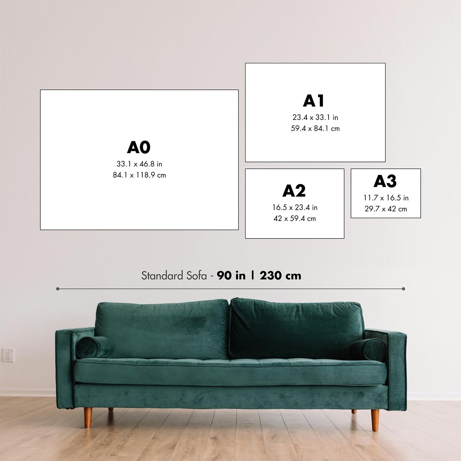
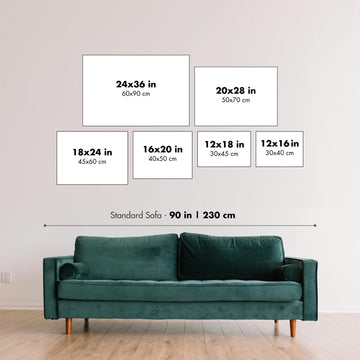
Diese Karte sieht in jeder Größe großartig aus, aber ich empfehle immer, eine größere Größe zu wählen, wenn Sie Platz haben. So können Sie alle Details leicht erkennen.
Diese Karte sieht in Größen bis zu 100 Zoll (250 cm) fantastisch aus. Wenn Sie nach einer größeren Karte suchen, bitte kontaktieren Sie uns.
Bitte beachten Sie: Die Beschriftungen auf dieser Karte sind schwer zu lesen, wenn Sie eine Karte bestellen, die 20 Zoll (50 cm) oder kleiner ist. Die Karte ist immer noch sehr ansprechend, aber wenn Sie die Karte leicht lesen möchten, kaufen Sie bitte eine größere Größe.
Das Modell in den Angebotsbildern hält die 24x36 Zoll (60x90 cm) Version dieser Karte.
Das fünfte Angebotsbild zeigt ein Beispiel meines Personalisierungsservices für Karten.
Wenn Sie nach etwas etwas anderem suchen, schauen Sie sich meine Sammlung der besten alten Karten an, um zu sehen, ob etwas anderes Ihr Interesse weckt.
Bitte kontaktieren Sie mich, um zu überprüfen, ob ein bestimmter Ort, ein Wahrzeichen oder ein Merkmal auf dieser Karte angezeigt wird.
Dies wäre ein wunderbares Geschenk zum Geburtstag, zu Weihnachten, zum Vatertag, zum Abschied von der Arbeit, zum Jubiläum oder zur Einweihung für jemanden aus den in dieser Karte abgedeckten Gebieten.
Diese Karte ist als Giclée-Druck auf säurefreiem, archiviertem mattem Papier erhältlich, oder Sie können sie gerahmt kaufen. Der Rahmen ist ein schöner, einfacher schwarzer Rahmen, der zu den meisten Ästhetiken passt. Bitte kontaktieren Sie mich, wenn Sie eine andere Rahmenfarbe oder -material wünschen. Meine Rahmen sind mit superklarem museumsgeschütztem Acryl (Plexiglas/Acrylit) verglast, das deutlich weniger reflektiert als Glas, sicherer ist und immer in einwandfreiem Zustand ankommt.
This map is also available as a float framed canvas, sometimes known as a shadow gap framed canvas or canvas floater. The map is printed on artist's cotton canvas and then stretched over a handmade box frame. We then "float" the canvas inside a wooden frame, which is available in a range of colours (black, dark brown, oak, antique gold and white). This is a wonderful way to present a map without glazing in front. See some examples of float framed canvas maps and explore the differences between my different finishes.
For something truly unique, this map is also available in "Unique 3D", our trademarked process that dramatically transforms the map so that it has a wonderful sense of depth. We combine the original map with detailed topography and elevation data, so that mountains and the terrain really "pop". For more info and examples of 3D maps, check my Unique 3D page.
Für die meisten Bestellungen beträgt die Lieferzeit etwa 3 Werktage. Personalisierte und maßgeschneiderte Produkte benötigen länger, da ich die Personalisierung durchführen und sie Ihnen zur Genehmigung zusenden muss, was normalerweise 1 oder 2 Tage dauert.
Bitte beachten Sie, dass sehr große gerahmte Bestellungen in der Regel länger für die Herstellung und Lieferung benötigen.
Wenn Sie möchten, dass Ihre Bestellung bis zu einem bestimmten Datum ankommt, bitte kontaktieren Sie mich, bevor Sie bestellen, damit wir den besten Weg finden können, um sicherzustellen, dass Sie Ihre Bestellung rechtzeitig erhalten.
Ich drucke und rahme Karten und Kunstwerke in 23 Ländern weltweit. Das bedeutet, dass Ihre Bestellung lokal gefertigt wird, was die Lieferzeit verkürzt und sicherstellt, dass sie während der Lieferung nicht beschädigt wird. Sie zahlen nie Zoll oder Einfuhrgebühren, und wir stoßen weniger CO2 in die Luft aus.
Alle meine Karten und Kunstdrucke sind gut verpackt und werden in einem robusten Rohr versendet, wenn sie ungerahmt sind, oder von Schaum umgeben, wenn sie gerahmt sind.
Ich versuche, alle Bestellungen innerhalb von 1 oder 2 Tagen nach Erhalt Ihrer Bestellung zu versenden, obwohl einige Produkte (wie Gesichtsmasken, Tassen und Tragetaschen) länger zur Herstellung benötigen können.
Wenn Sie Express-Lieferung an der Kasse auswählen, priorisieren wir Ihre Bestellung und versenden sie per 1-Tages-Kurier (Fedex, DHL, UPS, Parcelforce).
Nächster Tag Lieferung ist auch in einigen Ländern verfügbar (USA, UK, Singapur, VAE), aber bitte versuchen Sie, früh am Tag zu bestellen, damit wir es rechtzeitig versenden können.
Lesen Sie meinen vollständigen Leitfaden zur Lieferung und lokalen Produktion
Mein Standardrahmen ist ein Galerie-Stil-Rahmen aus schwarzem Eschenholz. Er ist einfach und sieht ziemlich modern aus. Mein Standardrahmen ist etwa 20 mm (0,8 Zoll) breit.
Ich verwende super-klares Acryl (Plexiglas/Acrylt) für das Glas des Rahmens. Es ist leichter und sicherer als Glas – und es sieht besser aus, da die Reflexion geringer ist.
Sechs Standardrahmenfarben sind kostenlos erhältlich (schwarz, dunkelbraun, dunkelgrau, Eiche, weiß und antikgold).
Die meisten Karten, Kunstwerke und Illustrationen sind auch als gerahmte Leinwand erhältlich. Wir verwenden matte (nicht glänzende) Baumwollleinwand, spannen sie über einen nachhaltig beschafften Buchenrahmen und 'schweben' dann das Stück innerhalb eines Holzrahmens. Das Endergebnis ist ziemlich schön, und es gibt keine Verglasung, die im Weg ist.
Alle Rahmen werden "bereit zum Aufhängen" geliefert, entweder mit einer Schnur oder Halterungen auf der Rückseite. Sehr große Rahmen haben schwere Aufhängeplatten und/oder eine Montageschiene. Wenn Sie Fragen haben, können Sie bitte Kontakt aufnehmen.
Sehen Sie sich einige Beispiele meiner gerahmten Karten und gerahmten Leinwandkarten an.
Alternativ kann ich auch alte Karten und Kunstwerke auf Leinwand, Schaumstoffplatten, Baumwollrag und andere Materialien liefern.
Wenn Sie Ihre Karte oder Ihr Kunstwerk selbst rahmen möchten, lesen Sie bitte zuerst meinen Größenleitfaden.
Einige meiner alten Karten sind jetzt als gerahmte Leinwände erhältlich. Bitte kontaktiere mich, wenn du eine Größe bestellen möchtest, die in meinem Shop nicht verfügbar ist.
Leinwand alte Karten sind eine interessante Alternative zu konventionell gerahmten Karten. Je nach deinem persönlichen Geschmack und der Raumdekoration können Leinwandkarten etwas mehr „herausstechen“ als eine gerahmte Karte.
Meine Karten sind äußerst hochwertige Reproduktionen von Originalkarten.
Ich beziehe originale, seltene Karten aus Bibliotheken, Auktionshäusern und Privatsammlungen auf der ganzen Welt, restauriere sie in meiner Londoner Werkstatt und erstelle dann mit speziellen Giclée-Tinten und -Druckern wunderschöne Karten, die sogar noch besser aussehen als das Original.
Meine Karten werden auf säurefreiem, mattem Archivpapier (nicht glänzend) gedruckt, das sich sehr hochwertig anfühlt und fast wie Karton aussieht. Technisch gesehen beträgt das Papiergewicht/die Papierdicke 10mil/200g/m². Es eignet sich perfekt zum Einrahmen.
Ich drucke mit UV-lichtbeständigen Ultrachrome-Giclée-Pigmenttinten von Epson – einige der besten Tinten, die Sie finden können.
Ich kann auch machen Karten auf Leinwand, Baumwolllappen und andere exotische Materialien.
Erfahren Sie mehr über The Unique Maps Co.
Kartenpersonalisierung
Wenn Sie nach dem perfekten Geschenk zum Jahrestag oder zur Einweihung suchen, kann ich Ihre Karte personalisieren, um sie wirklich einzigartig zu machen. Ich kann beispielsweise eine kurze Nachricht hinzufügen, einen wichtigen Ort hervorheben oder das Wappen Ihrer Familie hinzufügen.
Die Möglichkeiten sind nahezu unbegrenzt. Bitte sehen Sie sich meine Kartenpersonalisierungsseite für einige wunderbare Beispiele dessen, was möglich ist.
Um eine personalisierte Karte zu bestellen, wählen Sie „Personalisieren Sie Ihre Karte“, bevor Sie sie in den Warenkorb legen.
In Kontakt kommen wenn Sie nach komplexeren Anpassungen und Personalisierungen suchen.
Kartenalterung
Im Laufe der Jahre wurde ich von Kunden hunderte Male gefragt, ob sie eine Karte kaufen könnten, die noch älter.
Nun, jetzt können Sie das, indem Sie „Alter“ auswählen, bevor Sie eine Karte in Ihren Warenkorb legen.
Alle Produktfotos, die Sie auf dieser Seite sehen, zeigen die Karte in ihrer Originalform. So sieht die Karte heute aus.
Wenn Sie „Gealtert“ auswählen, werde ich Ihre Karte von Hand altern lassen. Dazu verwende ich ein spezielles und einzigartiges Verfahren, das ich durch jahrelanges Studium alter Karten und Gespräche mit Forschern zum Verständnis der Chemie alternder Papiere entwickelt habe, und natürlich ... viel Übung!
Wenn Sie sich nicht sicher sind, bleiben Sie bei der Originalfarbe der Karte. Wenn Sie etwas Dunkleres und älter Wenn Sie auf der Suche sind, entscheiden Sie sich für „Aged“.
Sehen Sie einige erstaunliche Beispiele für gealterte Karten.
Wenn Sie aus irgendeinem Grund mit Ihrer Bestellung nicht zufrieden sind, kontaktieren Sie mich für eine unkomplizierte Rückerstattung. Bitte sehen Sie sich unsere Rückgabe- und Rückerstattungsrichtlinien für weitere Informationen an.
Ich bin sehr zuversichtlich, dass Ihnen Ihre restaurierte Karte oder Kunstdruck gefallen wird. Ich mache das seit 1984. Ich bin ein 5-Sterne Etsy-Verkäufer. Ich habe Zehntausende von Karten und Kunstdrucken verkauft und habe über 5.000 echte 5-Sterne-Bewertungen.
Ich verwende einen einzigartigen Prozess, um Karten und Kunstwerke zu restaurieren, der extrem zeitaufwendig und arbeitsintensiv ist. Die Suche nach den Originalkarten und Illustrationen kann Monate dauern. Ich benutze modernste und unglaublich teure Technologie, um sie zu scannen und wiederherzustellen. Daher garantiere ich, dass meine Karten und Kunstdrucke eine Klasse für sich sind - deshalb kann ich eine unkomplizierte Rückerstattung anbieten.
Fast alle meine Karten und Kunstdrucke sehen in großen Größen (200 cm, 6,5 Fuß+) erstaunlich aus und ich kann sie Ihnen auch gerahmt und über einen speziellen Übergrößen-Kurier liefern. Kontaktieren Sie mich, um Ihre speziellen Bedürfnisse zu besprechen.
Or try searching for something!


