

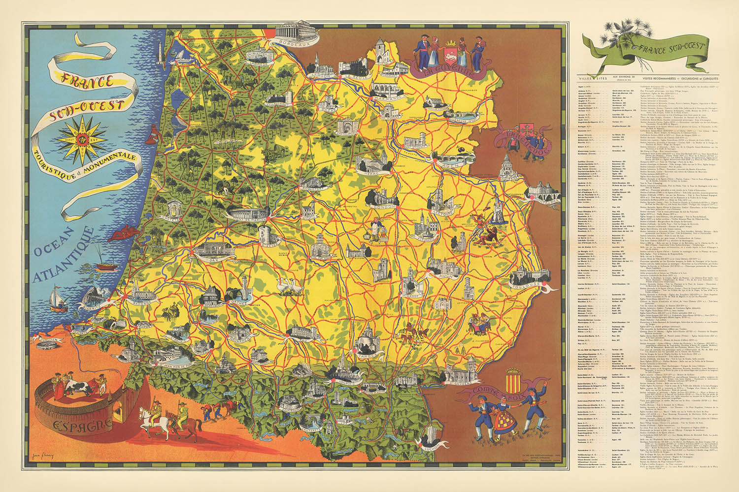


Mapa pictórico del suroeste de Francia por Flornoy Jean, 1950: Toulouse, Burdeos, Pirineos, río Garona, Camino de Santiago

-
![]() Handmade locally in the EU
Handmade locally in the EU
-
FREE worldwide delivery in 2-3 days ⓘ
Free delivery in 2-3 days
Your map should be delivered in 2-3 working days with free delivery, worldwide.
We make maps by hand locally in 23 countries, including the EU
![]() . If you're buying a gift for someone in another country, we will make the map locally to them.
. If you're buying a gift for someone in another country, we will make the map locally to them.You will never pay import tax or customs duty.
Express delivery is available at checkout which can reduce the delivery time to 1-2 days.
Please note that personalised maps, and larger framed maps, can take longer to produce and deliver.
If you need your order to arrive by a certain date, contact me and we can discuss your options.
-
90 day money back guarantee
ⓘ
90 días para devolver y reembolsar
Los productos se pueden devolver dentro de los 90 días para un reembolso completo, o cambio por otro producto.
Para artículos personalizados o hechos a medida, podemos ofrecerte un crédito en la tienda o una tarjeta de regalo que no caduca, ya que no podemos revender pedidos personalizados.
Si tienes alguna pregunta, ponte en contacto. Para más información, consulta nuestra política de devoluciones y cambios.

My maps are rare, museum-grade, restored old maps sourced from libraries, auction houses and private collections across the globe.
Framing & free personalisation available
1. Select your size
2. Frame & personalise your map
Make your map unique with framing, hand-drawn customisation, vintage ageing, pop art text, unique 3D styling and moreMensaje de regalo y acabado personalizado

Si deseas agregar un mensaje de regalo, o un acabado (rompecabezas, tablero de aluminio, etc.) que no esté disponible aquí, por favor solicítalo en la "nota del pedido" cuando realices la compra.
Cada pedido es hecho a medida, así que si necesitas que el tamaño se ajuste ligeramente, o que se imprima en un material inusual, háznoslo saber. Hemos realizado miles de pedidos personalizados a lo largo de los años, así que hay (casi) nada que no podamos gestionar.
También puedes contactarnos antes de hacer tu pedido, ¡si lo prefieres!

- Handmade locally. No import duty or tax
- FREE Delivery. Arrives in 2-3 days
- Love it or your money back
- Questions? WhatsApp me any time
Own a piece of history
5,000+ 5 star reviews


Sumérgete en los paisajes encantadores y la rica herencia del suroeste de Francia con "Francia Sud - Oeste Turística y Monumental," un cautivador mapa pictórico creado por el estimado cartógrafo Flornoy Jean en 1950. Este mapa, cuyo título se traduce como "Francia Suroeste - Turística y Monumental," es una oda visual a una región conocida por su vibrante cultura, sus ciudades históricas y su impresionante paisaje. Fue diseñado meticulosamente para guiar a los viajeros y entusiastas de la historia, ofreciendo una mezcla armoniosa de información práctica de viaje y celebración artística de los monumentos más queridos de la región.
Flornoy Jean, un maestro de la cartografía francesa de mediados del siglo XX, fue aclamado por su capacidad para combinar precisión con arte. Sus mapas se distinguen por sus detalladas ilustraciones y toques temáticos, transformando la documentación geográfica en obras de arte. En este mapa, la mano de Jean da vida a los exuberantes valles de la Dordogne, los dramáticos picos de los Pirineos y los sinuosos cursos de los ríos Garona y Dordogne. Su enfoque eleva el mapa más allá de una mera navegación, ofreciendo una ventana al alma de la región y un testimonio del atractivo duradero de la tradición cartográfica francesa.
El diseño del mapa es un festín para los ojos, presentando castillos ricamente ilustrados, catedrales románicas y góticas, y la intrincada red de rutas de peregrinación como el famoso Camino de Santiago. Puentes icónicos, como el medieval Pont Valentré en Cahors, y maravillas naturales como el vasto bosque de Landes de Gascogne y el Parque Nacional de los Pirineos, están todos representados con meticuloso cuidado. Cada viñeta y símbolo invita al espectador a explorar la historia en capas de la región, desde cuevas prehistóricas hasta ciudades bastidas medievales, y desde antiguos balnearios hasta célebres viñedos.
Esta obra maestra cartográfica abarca una constelación de ciudades y pueblos llenos de historia, incluyendo Toulouse, Burdeos, Pau y Bayona, cada uno representado con reverencia por su carácter y significado únicos. Los límites del mapa se extienden desde las playas de arena y puertos bulliciosos de la costa atlántica, a través de la fértil región vinícola de Burdeos, hasta las fronteras montañosas de los Pirineos. Traza elegantemente las arterias del comercio y la cultura, capturando la esencia del suroeste de Francia en un momento crucial de su renacimiento posterior a la guerra.
Históricamente, "Francia Sud - Oeste Turística y Monumental" refleja un período de renovado interés en la identidad regional, el turismo y la preservación cultural en Francia. Se presenta tanto como una guía práctica como un recurso educativo, invitando a los coleccionistas y conocedores modernos a experimentar la grandeza y diversidad de esta amada región tal como fue celebrada en la mitad del siglo XX. Para aquellos que aprecian la intersección de la historia, la geografía y el arte, este mapa ofrece un evocador viaje a través del tiempo y el lugar, guiado por la mano de uno de los más talentosos cartógrafos de Francia.
Ciudades y pueblos en este mapa
- Toulouse
- Burdeos
- Pau
- Bayona
- Tarbes
- Agen
- Montauban
- Périgueux
- Cahors
- Auch
- Dax
- Lourdes
- Bergerac
- Biarritz
- Mont-de-Marsan
- Albi
- Foix
- Sarlat-la-Canéda
- Saint-Jean-de-Luz
- Condom
Características y Monumentos Notables
- La cordillera de los Pirineos, representada a lo largo del borde sur
- La costa atlántica, incluyendo playas notables y características costeras
- El río Garona, que atraviesa la región
- El río Dordoña, otra vía fluvial importante
- El Canal del Midi, un canal histórico que une el Atlántico con el Mediterráneo
- Viñedos y regiones vinícolas, particularmente alrededor de Burdeos
- Castillos y châteaux, ilustrados a lo largo de la región
- Catedrales románicas y góticas, destacadas como sitios monumentales
- Rutas de peregrinación, incluyendo el Camino de Santiago
- Áreas forestales, como el bosque de las Landas de Gascuña
- Cuevas y sitios prehistóricos, notablemente en la región de Dordoña
- Balnearios termales, indicados en las estribaciones pirenaicas
- Parques regionales y reservas naturales, como el Parque Nacional de los Pirineos
- Pueblos bastida fortificados, mostrados con iconografía distintiva
Contexto histórico y de diseño
- Nombre del mapa: Francia Sud - Ouest Turístico y Monumental
- Cartógrafo: Flornoy Jean, conocido por sus mapas regionales detallados y artísticos
- Fecha de creación: 1950
- Tipo: Mapa temático y pictórico de condado o estado
- Región representada: Suroeste de Francia, cubriendo los Pirineos (sur), Burdeos (norte) y Toulouse (este)
- Estilo: Mapa pictórico, con hitos ilustrados e íconos temáticos que resaltan características culturales y geográficas
- Valor educativo: Proporciona tanto orientación de viaje como contexto histórico para el patrimonio de la región
- Significado histórico: Refleja el interés de la posguerra en el turismo regional y el patrimonio cultural en Francia
- Elementos de diseño: Ricamente ilustrado con dibujos de monumentos, características naturales y símbolos temáticos
- El mapa ofrece una instantánea histórica de la época, omitiendo desarrollos de infraestructura moderna posteriores a 1950
Por favor, verifique las imágenes para asegurarse de que una ciudad o lugar específico esté mostrado en este mapa. También puede ponerse en contacto y pedirnos que verifiquemos el mapa por usted.
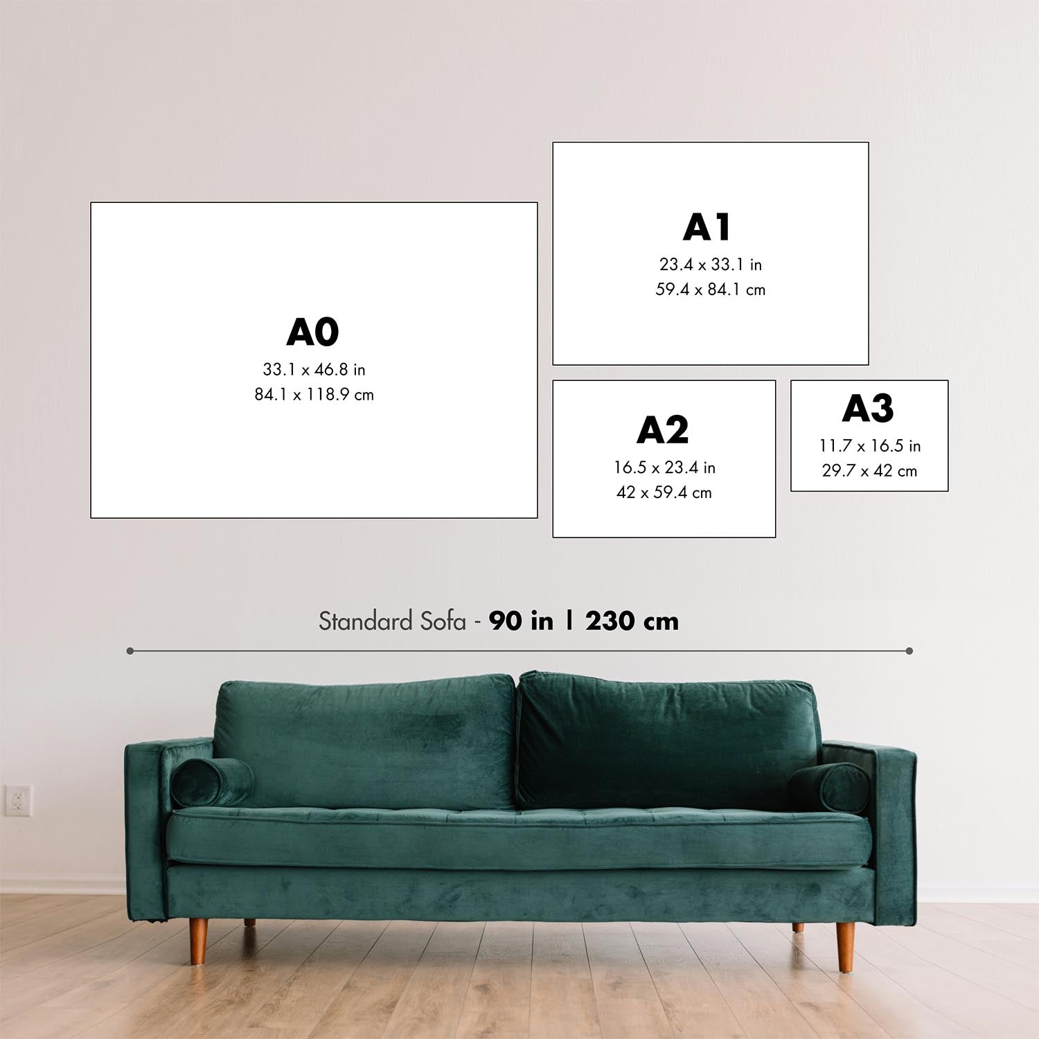
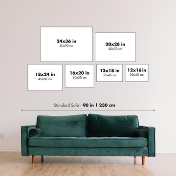
Este mapa se ve genial en cualquier tamaño, pero siempre recomiendo optar por un tamaño más grande si tiene espacio. De esa manera, puede distinguir fácilmente todos los detalles.
Este mapa se ve increíble en tamaños de hasta 100in (250cm). Si está buscando un mapa más grande, por favor póngase en contacto.
Por favor, tenga en cuenta: las etiquetas en este mapa son difíciles de leer si pide un mapa que tenga 20in (50cm) o menos. El mapa sigue siendo muy atractivo, pero si desea leer el mapa fácilmente, por favor compre un tamaño más grande.
El modelo en las imágenes de la lista sostiene la versión de 24x36in (60x90cm) de este mapa.
La quinta imagen de la lista muestra un ejemplo de mi servicio de personalización de mapas.
Si está buscando algo ligeramente diferente, eche un vistazo a mi colección de los mejores mapas antiguos para ver si algo más llama su atención.
Por favor contácteme para verificar si una ubicación, hito o característica determinada está mostrado en este mapa.
Esto sería un maravilloso regalo de cumpleaños, Navidad, Día del Padre, despedida laboral, aniversario o inauguración de casa para alguien de las áreas cubiertas por este mapa.
Este mapa está disponible como una impresión giclée en papel mate de archivo libre de ácido, o puedes comprarlo enmarcado. El marco es un bonito y simple marco negro que se adapta a la mayoría de las estéticas. Por favor, ponte en contacto si deseas un color o material de marco diferente. Mis marcos están envidriados con acrílico de museo superclaro (perspex/acrylite), que es significativamente menos reflectante que el vidrio, más seguro, y siempre llegará en perfectas condiciones.
This map is also available as a float framed canvas, sometimes known as a shadow gap framed canvas or canvas floater. The map is printed on artist's cotton canvas and then stretched over a handmade box frame. We then "float" the canvas inside a wooden frame, which is available in a range of colours (black, dark brown, oak, antique gold and white). This is a wonderful way to present a map without glazing in front. See some examples of float framed canvas maps and explore the differences between my different finishes.
For something truly unique, this map is also available in "Unique 3D", our trademarked process that dramatically transforms the map so that it has a wonderful sense of depth. We combine the original map with detailed topography and elevation data, so that mountains and the terrain really "pop". For more info and examples of 3D maps, check my Unique 3D page.
Para la mayoría de los pedidos, el tiempo de entrega es de aproximadamente 3 días laborables. Los productos personalizados y a medida tardan más, ya que tengo que hacer la personalización y enviártelo para su aprobación, lo cual suele tardar 1 o 2 días.
Tenga en cuenta que los pedidos enmarcados muy grandes suelen tardar más en fabricarse y entregarse.
Si necesitas que tu pedido llegue para una fecha determinada, por favor contáctame antes de hacer el pedido para que podamos encontrar la mejor manera de asegurarnos de que recibas tu pedido a tiempo.
Imprimo y enmarco mapas y obras de arte en 23 países alrededor del mundo. Esto significa que tu pedido se fabricará localmente, lo que reduce el tiempo de entrega y asegura que no se dañe durante el envío. Nunca pagarás aranceles de aduana o impuestos de importación, y pondremos menos CO2 en el aire.
Todos mis mapas y impresiones artísticas están bien empaquetados y enviados en un tubo resistente si no están enmarcados, o rodeados de espuma si están enmarcados.
Intento enviar todos los pedidos dentro de 1 o 2 días después de recibir tu pedido, aunque algunos productos (como mascarillas, tazas y bolsas de tela) pueden tardar más en fabricarse.
Si seleccionas Entrega Exprés al finalizar la compra, priorizaremos tu pedido y lo enviaremos por mensajería de 1 día (Fedex, DHL, UPS, Parcelforce).
La entrega al día siguiente también está disponible en algunos países (EE. UU., Reino Unido, Singapur, EAU), pero por favor intenta hacer tu pedido temprano en el día para que podamos enviarlo a tiempo.
Mi marco estándar es un marco de madera de fresno negro estilo galería. Es simple y tiene un aspecto bastante moderno. Mi marco estándar tiene alrededor de 20 mm (0.8 in) de ancho.
Utilizo acrílico super claro (perspex/acrylite) para el vidrio del marco. Es más ligero y seguro que el vidrio, y se ve mejor, ya que la reflectividad es menor.
Seis colores de marco estándar están disponibles de forma gratuita (negro, marrón oscuro, gris oscuro, roble, blanco y oro antiguo).El enmarcado y montaje/matizado personalizado está disponible si buscas algo diferente.
La mayoría de los mapas, arte e ilustraciones también están disponibles como un lienzo enmarcado. Utilizamos lienzo de algodón mate (no brillante), lo estiramos sobre un marco de madera de caja de origen sostenible, y luego 'flotamos' la pieza dentro de un marco de madera. El resultado final es bastante hermoso, y no hay cristal que se interponga.
Todos los marcos se proporcionan "listos para colgar", con una cuerda o soportes en la parte posterior. Los marcos muy grandes tendrán placas de colgar de alta resistencia y/o un listón de montaje. Si tienes alguna pregunta, por favor ponte en contacto.
Mira algunos ejemplos de mis mapas enmarcados y mapas en lienzo enmarcados.
Alternativamente, también puedo proporcionar mapas antiguos y obras de arte en lienzo, tablero de espuma, papel de algodón y otros materiales.
Si deseas enmarcar tu mapa o obra de arte tú mismo, por favor lee mi guía de tamaños primero.
Algunos de mis mapas antiguos ahora están disponibles como lienzos enmarcados. Por favor contáctame si deseas pedir un tamaño que no está disponible en mi tienda.
Los mapas antiguos en lienzo son una alternativa interesante a los mapas enmarcados convencionalmente. Dependiendo de tu gusto personal y la decoración de la habitación, los mapas en lienzo pueden "destacar" un poco más que un mapa enmarcado.
Mis mapas son reproducciones de mapas originales de altísima calidad.
Obtengo mapas originales y raros de bibliotecas, casas de subastas y colecciones privadas de todo el mundo, los restauro en mi taller de Londres y luego uso tintas e impresoras giclée especializadas para crear hermosos mapas que lucen incluso mejor que el original.
Mis mapas están impresos en papel de archivo mate (no brillante) sin ácido que se siente de muy alta calidad y casi como una tarjeta. En términos técnicos, el peso/grosor del papel es de 10 mil/200 g/m². Es perfecto para enmarcar.
Imprimo con tintas pigmentadas Epson ultrachrome giclée UV resistentes a la decoloración, algunas de las mejores tintas que puedes encontrar.
yo también puedo hacer mapas sobre lienzo, trapo de algodón y otros materiales exóticos.
Obtenga más información sobre The Unique Maps Co..
Personalización de mapas
Si está buscando el regalo perfecto de aniversario o inauguración de la casa, puedo personalizar su mapa para hacerlo verdaderamente único. Por ejemplo, puedo agregar un mensaje corto, resaltar una ubicación importante o agregar el escudo de armas de su familia.
Las opciones son casi infinitas. Por favor mira mi página de personalización de mapas para ver algunos maravillosos ejemplos de lo que es posible.
Para pedir un mapa personalizado, seleccione "personalizar su mapa" antes de agregarlo a su carrito.
Ponerse en contacto si buscas personalizaciones y personalizaciones más complejas.
Envejecimiento del mapa
A lo largo de los años, los clientes me han preguntado cientos de veces si podían comprar un mapa que se viera uniforme. más viejo.
Bueno, ahora puedes hacerlo seleccionando Envejecido antes de agregar un mapa a tu carrito.
Todas las fotografías de productos que ve en esta página muestran el mapa en su forma original. Así es como se ve el mapa hoy.
Si selecciona Envejecido, envejeceré su mapa a mano, usando un proceso especial y único desarrollado a través de años de estudiar mapas antiguos, hablar con investigadores para comprender la química del envejecimiento del papel y, por supuesto... ¡mucha práctica!
Si no estás seguro, quédate con el color original del mapa. Si quieres algo un poco más oscuro y más viejo buscando, opte por Envejecido.
Si no estás satisfecho con tu pedido por cualquier motivo, contáctame para un reembolso sin complicaciones. Por favor, consulta nuestra política de devoluciones y reembolsos para más información.
Estoy muy seguro de que te gustará tu mapa o impresión artística restaurada. He estado haciendo esto desde 1984. Soy un vendedor de 5 estrellas en Etsy. He vendido decenas de miles de mapas e impresiones artísticas y tengo más de 5,000 opiniones reales de 5 estrellas.
Utilizo un proceso único para restaurar mapas y obras de arte que consume mucho tiempo y mano de obra. Buscar los mapas e ilustraciones originales puede llevar meses. Utilizo tecnología de última generación y extremadamente cara para escanear y restaurarlos. Como resultado, garantizo que mis mapas e impresiones artísticas son superiores a los demás - por eso puedo ofrecer un reembolso sin complicaciones.
Casi todos mis mapas e impresiones artísticas se ven increíbles en tamaños grandes (200cm, 6.5ft+) y también puedo enmarcarlos y entregártelos a través de un servicio de mensajería especial para tamaños grandes. Contáctame para discutir tus necesidades específicas.
Or try searching for something!


