


Old Map of US College Football by Sundberg, 1942: Major Teams, Conferences, WW2 Era

-
![]() Handmade locally in the EU
Handmade locally in the EU
-
Christmas delivery: check the deadline
Free delivery in 2-3 days
Your map should be delivered in 2-3 working days with free delivery, worldwide.
Please order by 11am ET Monday with Next Day delivery at checkout for Christmas delivery. Canvases will not arrive for Christmas. Unframed orders have a better chance of arriving in time.
New for 2024: You can send a beautiful gift preview by email, if you think your order won't arrive on time.
We make maps by hand locally in 23 countries, including the EU
![]() . If you're buying a gift for someone in another country, we will make the map locally to them.
. If you're buying a gift for someone in another country, we will make the map locally to them.You will never pay import tax or customs duty.
Some orders are now taking 5-6 days to arrive because of postal slowdowns. Please order soon to ensure you get your order before Christmas. Check my Christmas delivery guide for more info.
Express delivery is available at checkout which can reduce the delivery time to 1-2 days.
Please note that personalised maps, and larger framed maps, can take longer to produce and deliver.
If you need your order to arrive by a certain date, contact me and we can discuss your options.
-
90 day money back guarantee
ⓘ
90 días para devolver y reembolsar
Los productos se pueden devolver dentro de los 90 días para un reembolso completo, o cambio por otro producto.
Para artículos personalizados o hechos a medida, podemos ofrecerte un crédito en la tienda o una tarjeta de regalo que no caduca, ya que no podemos revender pedidos personalizados.
Si tienes alguna pregunta, ponte en contacto. Para más información, consulta nuestra política de devoluciones y cambios.

My maps are rare, museum-grade, restored old maps sourced from libraries, auction houses and private collections across the globe.
Framing & free personalisation available
1. Select your size
2. Frame & personalise your map
Make your map unique with framing, hand-drawn customisation, vintage ageing, pop art text, unique 3D styling and moreMensaje de regalo y acabado personalizado

Si deseas agregar un mensaje de regalo, o un acabado (rompecabezas, tablero de aluminio, etc.) que no esté disponible aquí, por favor solicítalo en la "nota del pedido" cuando realices la compra.
Cada pedido es hecho a medida, así que si necesitas que el tamaño se ajuste ligeramente, o que se imprima en un material inusual, háznoslo saber. Hemos realizado miles de pedidos personalizados a lo largo de los años, así que hay (casi) nada que no podamos gestionar.
También puedes contactarnos antes de hacer tu pedido, ¡si lo prefieres!

- Handmade locally. No import duty or tax
- FREE Delivery. Arrives in 2-3 days
- Love it or your money back
- Questions? WhatsApp me any time
Own a piece of history
5,000+ 5 star reviews


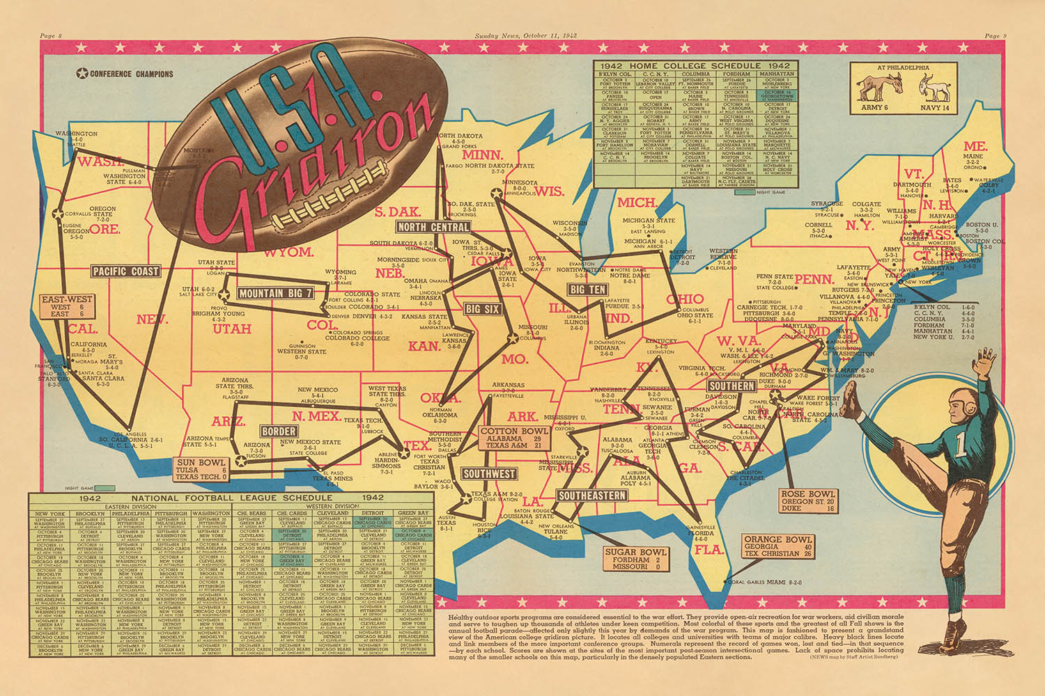
Step into the dynamic world of mid-century American sport with "U.S.A. Gridiron," an exuberant pictorial map created by Edwin L. Sundberg in 1942. Commissioned by the Sunday News of New York City, this map offers a vibrant tableau of the nation at a pivotal moment in history. With its full-color centerfold design, "U.S.A. Gridiron" captures the spirit of college football during World War II, presenting a “grandstand view of the American College gridiron picture.” The map’s intricate network of black lines connects the country’s leading collegiate football teams, while numbered boxes meticulously document their records, inviting viewers to trace the rivalries and triumphs that defined the 1942 season.
Edwin L. Sundberg, a distinguished map artist for the Sunday News, was renowned for his ability to distill complex subjects into visually compelling narratives. His work on "U.S.A. Gridiron" exemplifies this gift, blending the precision of cartography with the exuberance of American sports culture. Sundberg’s artistic flair shines through in the map’s playful illustrations—football players in action, goalposts, and helmets—transforming the map into a celebration of athleticism and camaraderie. This is more than a geographical document; it is a lively chronicle of American resilience and unity during a time of global upheaval.
Geographically, the map encompasses the entire United States, elegantly delineating state borders and featuring the country’s most iconic natural landmarks. The mighty Mississippi River winds its way through the heartland, while the Great Lakes shimmer in the north. Stylized mountain ranges, from the Rockies to the Appalachians, rise across the landscape, and the Atlantic and Pacific Oceans frame the nation’s expanse. Insets for Alaska and Hawaii, then territories, underscore the breadth of the American sporting landscape, while a decorative compass rose and thematic border lend a touch of period charm.
The map’s urban tapestry is as impressive as its natural features. It highlights major cities such as New York, Los Angeles, Chicago, and Houston—metropolises that remain powerhouses today—alongside storied college towns like Ann Arbor, Norman, and West Point. Each settlement is not merely a point on the map but a testament to the enduring legacy of collegiate athletics in shaping American identity. The map’s careful annotation of football conferences and game records offers a fascinating window into the era’s sporting rivalries, while its tables for the 1942 National Football League and Home College schedules provide a rare glimpse into the organizational fabric of wartime football.
Historically, "U.S.A. Gridiron" stands as a unique artifact of American culture, blending the excitement of sport with the artistry of cartography. Published during the uncertainty of World War II, it reflects the nation’s longing for continuity, entertainment, and pride. Sundberg’s creation is both a celebration of football’s golden age and a poignant reminder of the power of sport to unite communities across vast distances. For collectors and connoisseurs of Americana, this map is an evocative snapshot of a nation in motion—both on the field and across the landscape.
Cities and towns on this map
- New York City, NY
- Los Angeles, CA
- Chicago, IL
- Houston, TX
- Philadelphia, PA
- Dallas, TX
- San Francisco, CA
- Boston, MA
- Washington, D.C.
- Atlanta, GA
- Miami, FL
- Detroit, MI
- Seattle, WA
- Denver, CO
- Minneapolis, MN
- St. Louis, MO
- Pittsburgh, PA
- Cleveland, OH
- Cincinnati, OH
- Kansas City, MO
- Baltimore, MD
- New Orleans, LA
- Buffalo, NY
- Oklahoma City, OK
- Louisville, KY
- Portland, OR
- Columbus, OH
- Indianapolis, IN
- Milwaukee, WI
- Charlotte, NC
- Nashville, TN
- Salt Lake City, UT
- Raleigh, NC
- Richmond, VA
- Des Moines, IA
- Omaha, NE
- Birmingham, AL
- Providence, RI
- Tulsa, OK
- Lincoln, NE
- Madison, WI
- Lansing, MI
- Baton Rouge, LA
- Columbia, SC
- Fayetteville, AR
- Ames, IA
- Eugene, OR
- Stillwater, OK
- Laramie, WY
- Manhattan, KS
- Norman, OK
- West Point, NY (U.S. Military Academy)
- Annapolis, MD (U.S. Naval Academy)
Notable Features & Landmarks
- Illustrations of football players in action poses scattered across the map
- Black lines connecting schools within the same football conference
- Numbered boxes indicating win-loss records for teams
- Decorative border featuring football motifs and helmets
- Tables detailing the 1942 National Football League schedule and the Home College schedule
- Pictorial representations of footballs, goalposts, and other sports paraphernalia
- Stylized state borders for all U.S. states
- Major rivers (e.g., Mississippi River) and the Great Lakes illustrated for geographic context
Historical and design context
- Created by Edwin L. Sundberg, a distinguished map artist for the Sunday News, New York City
- Published on October 11, 1942, during World War II
- Offers a vibrant tableau of American college football and higher education institutions during the early 1940s
- Full-color, centerfold pictorial map, blending cartographic precision with playful illustration
- Reflects the intersection of sports, geography, and journalism in mid-20th-century America
- A rare artifact that captures the national morale and unity fostered by college football during wartime
- Presents a comprehensive snapshot of college football’s landscape, including conference rivalries and season records
Please double check the images to make sure that a specific town or place is shown on this map. You can also get in touch and ask us to check the map for you.
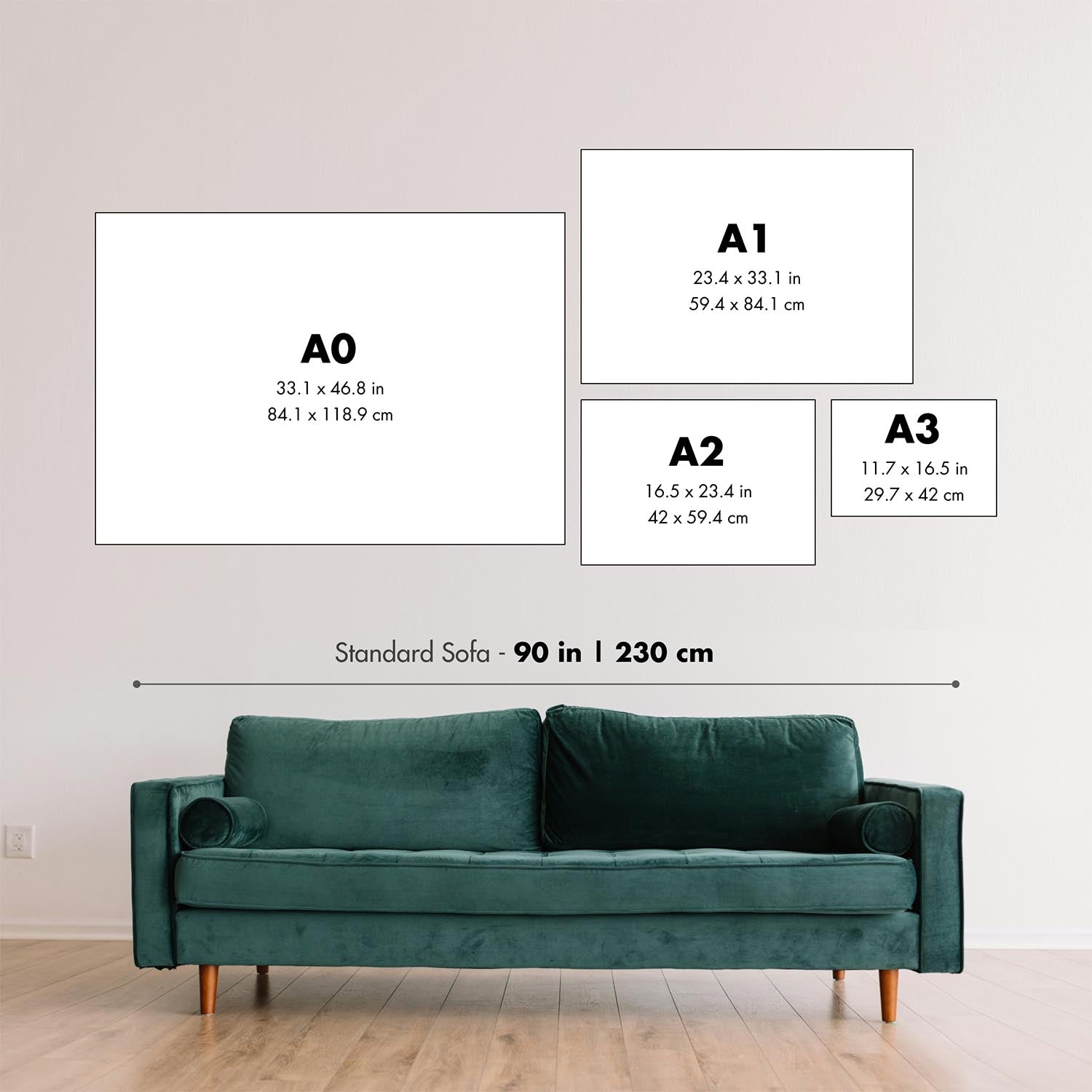
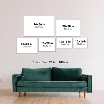
This map looks great at every size, but I always recommend going for a larger size if you have space. That way you can easily make out all of the details.
This map looks amazing at sizes all the way up to 90in (230cm). If you are looking for a larger map, please get in touch.
The model in the listing images is holding the 24x36in (60x90cm) version of this map.
The fifth listing image shows an example of my map personalisation service.
If you’re looking for something slightly different, check out my collection of the best old maps to see if something else catches your eye.
Please contact me to check if a certain location, landmark or feature is shown on this map.
This would make a wonderful birthday, Christmas, Father's Day, work leaving, anniversary or housewarming gift for someone from the areas covered by this map.
This map is available as a giclée print on acid free archival matte paper, or you can buy it framed. The frame is a nice, simple black frame that suits most aesthetics. Please get in touch if you'd like a different frame colour or material. My frames are glazed with super-clear museum-grade acrylic (perspex/acrylite), which is significantly less reflective than glass, safer, and will always arrive in perfect condition.
This map is also available as a float framed canvas, sometimes known as a shadow gap framed canvas or canvas floater. The map is printed on artist's cotton canvas and then stretched over a handmade box frame. We then "float" the canvas inside a wooden frame, which is available in a range of colours (black, dark brown, oak, antique gold and white). This is a wonderful way to present a map without glazing in front. See some examples of float framed canvas maps and explore the differences between my different finishes.
For something truly unique, this map is also available in "Unique 3D", our trademarked process that dramatically transforms the map so that it has a wonderful sense of depth. We combine the original map with detailed topography and elevation data, so that mountains and the terrain really "pop". For more info and examples of 3D maps, check my Unique 3D page.
Para la mayoría de los pedidos, el tiempo de entrega es de aproximadamente 3 días laborables. Los productos personalizados y a medida tardan más, ya que tengo que hacer la personalización y enviártelo para su aprobación, lo cual suele tardar 1 o 2 días.
Tenga en cuenta que los pedidos enmarcados muy grandes suelen tardar más en fabricarse y entregarse.
Si necesitas que tu pedido llegue para una fecha determinada, por favor contáctame antes de hacer el pedido para que podamos encontrar la mejor manera de asegurarnos de que recibas tu pedido a tiempo.
Imprimo y enmarco mapas y obras de arte en 23 países alrededor del mundo. Esto significa que tu pedido se fabricará localmente, lo que reduce el tiempo de entrega y asegura que no se dañe durante el envío. Nunca pagarás aranceles de aduana o impuestos de importación, y pondremos menos CO2 en el aire.
Todos mis mapas y impresiones artísticas están bien empaquetados y enviados en un tubo resistente si no están enmarcados, o rodeados de espuma si están enmarcados.
Intento enviar todos los pedidos dentro de 1 o 2 días después de recibir tu pedido, aunque algunos productos (como mascarillas, tazas y bolsas de tela) pueden tardar más en fabricarse.
Si seleccionas Entrega Exprés al finalizar la compra, priorizaremos tu pedido y lo enviaremos por mensajería de 1 día (Fedex, DHL, UPS, Parcelforce).
La entrega al día siguiente también está disponible en algunos países (EE. UU., Reino Unido, Singapur, EAU), pero por favor intenta hacer tu pedido temprano en el día para que podamos enviarlo a tiempo.
Mi marco estándar es un marco de madera de fresno negro estilo galería. Es simple y tiene un aspecto bastante moderno. Mi marco estándar tiene alrededor de 20 mm (0.8 in) de ancho.
Utilizo acrílico super claro (perspex/acrylite) para el vidrio del marco. Es más ligero y seguro que el vidrio, y se ve mejor, ya que la reflectividad es menor.
Seis colores de marco estándar están disponibles de forma gratuita (negro, marrón oscuro, gris oscuro, roble, blanco y oro antiguo).El enmarcado y montaje/matizado personalizado está disponible si buscas algo diferente.
La mayoría de los mapas, arte e ilustraciones también están disponibles como un lienzo enmarcado. Utilizamos lienzo de algodón mate (no brillante), lo estiramos sobre un marco de madera de caja de origen sostenible, y luego 'flotamos' la pieza dentro de un marco de madera. El resultado final es bastante hermoso, y no hay cristal que se interponga.
Todos los marcos se proporcionan "listos para colgar", con una cuerda o soportes en la parte posterior. Los marcos muy grandes tendrán placas de colgar de alta resistencia y/o un listón de montaje. Si tienes alguna pregunta, por favor ponte en contacto.
Mira algunos ejemplos de mis mapas enmarcados y mapas en lienzo enmarcados.
Alternativamente, también puedo proporcionar mapas antiguos y obras de arte en lienzo, tablero de espuma, papel de algodón y otros materiales.
Si deseas enmarcar tu mapa o obra de arte tú mismo, por favor lee mi guía de tamaños primero.
Algunos de mis mapas antiguos ahora están disponibles como lienzos enmarcados. Por favor contáctame si deseas pedir un tamaño que no está disponible en mi tienda.
Los mapas antiguos en lienzo son una alternativa interesante a los mapas enmarcados convencionalmente. Dependiendo de tu gusto personal y la decoración de la habitación, los mapas en lienzo pueden "destacar" un poco más que un mapa enmarcado.
Mis mapas son reproducciones de mapas originales de altísima calidad.
Obtengo mapas originales y raros de bibliotecas, casas de subastas y colecciones privadas de todo el mundo, los restauro en mi taller de Londres y luego uso tintas e impresoras giclée especializadas para crear hermosos mapas que lucen incluso mejor que el original.
Mis mapas están impresos en papel de archivo mate (no brillante) sin ácido que se siente de muy alta calidad y casi como una tarjeta. En términos técnicos, el peso/grosor del papel es de 10 mil/200 g/m². Es perfecto para enmarcar.
Imprimo con tintas pigmentadas Epson ultrachrome giclée UV resistentes a la decoloración, algunas de las mejores tintas que puedes encontrar.
yo también puedo hacer mapas sobre lienzo, trapo de algodón y otros materiales exóticos.
Obtenga más información sobre The Unique Maps Co..
Personalización de mapas
Si está buscando el regalo perfecto de aniversario o inauguración de la casa, puedo personalizar su mapa para hacerlo verdaderamente único. Por ejemplo, puedo agregar un mensaje corto, resaltar una ubicación importante o agregar el escudo de armas de su familia.
Las opciones son casi infinitas. Por favor mira mi página de personalización de mapas para ver algunos maravillosos ejemplos de lo que es posible.
Para pedir un mapa personalizado, seleccione "personalizar su mapa" antes de agregarlo a su carrito.
Ponerse en contacto si buscas personalizaciones y personalizaciones más complejas.
Envejecimiento del mapa
A lo largo de los años, los clientes me han preguntado cientos de veces si podían comprar un mapa que se viera uniforme. más viejo.
Bueno, ahora puedes hacerlo seleccionando Envejecido antes de agregar un mapa a tu carrito.
Todas las fotografías de productos que ve en esta página muestran el mapa en su forma original. Así es como se ve el mapa hoy.
Si selecciona Envejecido, envejeceré su mapa a mano, usando un proceso especial y único desarrollado a través de años de estudiar mapas antiguos, hablar con investigadores para comprender la química del envejecimiento del papel y, por supuesto... ¡mucha práctica!
Si no estás seguro, quédate con el color original del mapa. Si quieres algo un poco más oscuro y más viejo buscando, opte por Envejecido.
Si no estás satisfecho con tu pedido por cualquier motivo, contáctame para un reembolso sin complicaciones. Por favor, consulta nuestra política de devoluciones y reembolsos para más información.
Estoy muy seguro de que te gustará tu mapa o impresión artística restaurada. He estado haciendo esto desde 1984. Soy un vendedor de 5 estrellas en Etsy. He vendido decenas de miles de mapas e impresiones artísticas y tengo más de 5,000 opiniones reales de 5 estrellas.
Utilizo un proceso único para restaurar mapas y obras de arte que consume mucho tiempo y mano de obra. Buscar los mapas e ilustraciones originales puede llevar meses. Utilizo tecnología de última generación y extremadamente cara para escanear y restaurarlos. Como resultado, garantizo que mis mapas e impresiones artísticas son superiores a los demás - por eso puedo ofrecer un reembolso sin complicaciones.
Casi todos mis mapas e impresiones artísticas se ven increíbles en tamaños grandes (200cm, 6.5ft+) y también puedo enmarcarlos y entregártelos a través de un servicio de mensajería especial para tamaños grandes. Contáctame para discutir tus necesidades específicas.
Or try searching for something!


